Area Overview for IP3 8AL
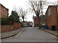
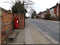
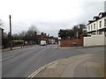
Photos of IP3 8AL


Area Information
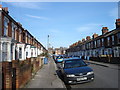
Living in IP3 8AL offers a compact, tightly knit residential experience. With a population of 1,758 spread across 4,108 square metres, the area is densely populated yet retains a distinct character. This postcode area is ideal for those seeking a small, manageable community with easy access to essential services. The presence of five nearby railway stations, including Derby Road Railway Station, ensures strong connectivity to surrounding regions. Daily life here is shaped by proximity to retail hubs like Tesco Duke and local co-operatives, offering convenience for shopping and errands. The area’s compact size means residents can navigate it on foot or by bike, fostering a sense of familiarity. While the population density is high, the community appears stable, with a median age of 47 and a focus on adult households. For buyers, IP3 8AL represents a blend of practicality and accessibility, though its small footprint means limited expansion potential. The area’s charm lies in its simplicity, with no major environmental constraints or planning restrictions to complicate living here.
- Area Type
- Postcode
- Area Size
- 4108 m²
- Population
- 1758
- Population Density
- 4691 people/km²
IP3 8AL is a small area with a housing stock dominated by houses rather than flats, which is unusual for its size. With a home ownership rate of 46%, the area leans more towards rental properties than owner-occupied homes. This suggests a transient or economically diverse population, where buyers may find limited opportunities for long-term investment. The compact nature of the area means property choices are constrained, and the immediate surroundings likely offer few alternatives. For buyers, this presents both challenges and clarity: the market is niche, but the demand for houses in a densely populated area may drive competition. The lack of planning constraints, such as protected nature reserves or AONB designations, could make development or renovation more straightforward. However, the high population density may limit future growth, making IP3 8AL a viable option for those prioritising convenience over expansion.
House Prices in IP3 8AL
No properties found in this postcode.
Energy Efficiency in IP3 8AL
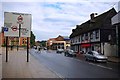
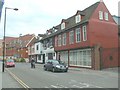
The lifestyle in IP3 8AL is defined by its proximity to essential amenities. Five retail outlets, including Tesco Duke and the East of England Co-operative Co, provide convenient shopping options for daily needs. These venues cater to both practical purchases and local services, supporting a self-sufficient community. The rail network, with five stations such as Derby Road Railway Station, offers easy access to nearby towns and cities, enhancing mobility for residents. While the area lacks large parks or leisure facilities, the compact layout ensures that amenities are within walking distance. This accessibility is a key feature for those prioritising convenience over expansive recreational spaces. The retail and transport infrastructure together create a functional environment, though the absence of cultural or entertainment hubs may require residents to travel further for such activities.
Amenities
Schools
| Rank | School | Type | Entry gender | Ages |
|---|
Explore more schools in this area
Go to Schools tabDemographics
The community in IP3 8AL is predominantly composed of adults aged 30–64, reflecting a median age of 47. This suggests a mature, established population with a focus on family life or long-term residency. Home ownership stands at 46%, indicating that nearly half of residents rent, which may influence the local property market’s dynamics. The area is characterised by houses rather than flats, aligning with the accommodation type data. The predominant ethnic group is White, with no specific data provided on other demographics. The population density of 427,962 people per square kilometre is exceptionally high, which may impact living conditions and community interactions. While no deprivation data is available, the high density and limited amenities suggest that residents rely heavily on nearby services. This profile points to a community that values proximity to transport and retail, with a focus on stability over novelty.
Household Size
Accommodation Type
Tenure
Ethnic Group
Religion
Household Composition
Age
Household Deprivation
NS-SEC
Explore more demographic insights in this area
Go to Demographics tabPlanning
Planning Constraints
- Flood RiskPremium
- Ramsar Wetland SitesPremium
- Area of Outstanding Natural BeautyPremium
- Protected Nature ReservePremium
- Protected WoodlandPremium