Area Overview for IP3 0RW
Photos of IP3 0RW
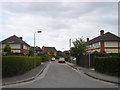
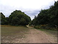
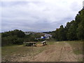
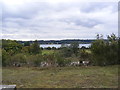
39 photos from this area
Area Information
Key information about the IP3 0RW including its size, population, and administrative classification.
- Area Type
- Postcode
- Area Size
- 6475 m²
- Population
- 1632
- Population Density
- 5268 people/km²
House Prices in IP3 0RW
18
Properties
£139,559
Average Sold Price
£61,710
Lowest Price
£232,000
Highest Price
Showing 18 properties
| Address | Type | Beds | Baths | Last Sale Price | Last Sale Date | |
|---|---|---|---|---|---|---|
| 258 Clapgate Lane, Ipswich, IP3 0RW | Semi-detached | 3 | 1 | £232,000 | Jun 2025 | |
| 295 Clapgate Lane, Ipswich, IP3 0RW | Semi-detached | 3 | - | £195,000 | Jun 2021 | |
| 262 Clapgate Lane, Ipswich, IP3 0RW | Semi-detached | 3 | 2 | £175,000 | Apr 2018 | |
| 266 Clapgate Lane, Ipswich, IP3 0RW | Semi-detached | 3 | 1 | £160,000 | Oct 2016 | |
| 277 Clapgate Lane, Ipswich, IP3 0RW | house | 3 | - | £90,000 | May 2013 | |
| 291 Clapgate Lane, Ipswich, IP3 0RW | Semi-detached | - | - | £61,710 | Oct 2003 | |
| 268 Clapgate Lane, Ipswich, IP3 0RW | Semi-detached | 3 | 1 | £63,200 | Dec 2001 | |
| 264 Clapgate Lane, Ipswich, IP3 0RW | house | 3 | - | - | - | |
| 293 Clapgate Lane, Ipswich, IP3 0RW | house | - | - | - | - | |
| 285 Clapgate Lane, Ipswich, IP3 0RW | house | - | - | - | - |
Page 1 of 2
Energy Efficiency in IP3 0RW
Amenities
Schools
| Rank | School | Type | Entry gender | Ages |
|---|
Explore more schools in this area
Go to Schools tabDemographics
Household Size
Family (3-5 people)
most common
Accommodation Type
Houses
most common
Tenure
37
majority
Ethnic Group
White
most common
Religion
N/A
most common
Household Composition
N/A
most common
Age
47
median
Adults (30-64 years)
most common
Household Deprivation
N/A
with no deprivation
NS-SEC
12
in Lower managerial occupations
Explore more demographic insights in this area
Go to Demographics tabPlanning
Planning Constraints
- Flood RiskPremium
- Ramsar Wetland SitesPremium
- Area of Outstanding Natural BeautyPremium
- Protected Nature ReservePremium
- Protected WoodlandPremium