Area Overview for IP3 0EE
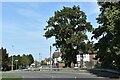
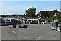
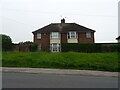
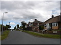
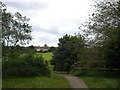
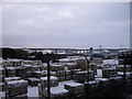
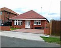
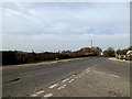
Photos of IP3 0EE
Area Information
IP3 0EE is a specific postcode area covering a small residential cluster in England. It comprises just 1.1 hectares of land and houses a population of 1649 people. This results in a population density of 965 people per square kilometre, indicating a compact living environment where neighbours are naturally close. The area is defined by its immediate residential focus rather than sprawling development. Daily life here revolves around the fact that you reside within a tightly defined geographical boundary. The sheer size of the postcode suggests that distances to key services are measurable in minutes rather than miles. You do not need to travel far for essentials because the area is dense with residents. Living in IP3 0EE means you are part of a concentrated community where the footprint of the neighbourhood is strictly limited. The area is not part of any protected zones such as Areas of Outstanding Natural Beauty or Ramsar wetland sites, which confirms it is built for rather than preserved around nature. This practical layout makes it suitable for those who value proximity to each other over vast open spaces. The postcode serves as a clear marker for a specific, small-scale housing provision.
- Area Type
- Postcode
- Area Size
- 1.1 hectares
- Population
- 1649
- Population Density
- 965 people/km²
The housing stock in IP3 0EE is characterised entirely by houses. This accommodation type defines the physical landscape of the 1.1-hectare area. Only 34% of households in this postcode own their homes outright or with a mortgage. The remaining majority reside in rental properties. This market structure suggests that you may find fewer traditional owner-occupier communities compared to areas with higher ownership rates. The dominance of houses indicates that the land use is primarily for detached or semi-detached living rather than terrace or flat living. Buying homes in IP3 0EE presents a specific scenario where rental stock is more prevalent than owner-occupied stock. The small size of the postcode area limits the total number of properties available for purchase. Given that three-quarters of residents do not own their homes, the area functions partly as a residential hub for tenants. You should expect a market where rental dynamics play a larger role than in many other suburbs. The lack of flats means your options are restricted to house-based living. For buyers, this means assessing the availability of houses that fit your specific needs within this very small geographical boundary.
House Prices in IP3 0EE
Showing 16 properties
| Address | Type | Beds | Baths | Last Sale Price | Last Sale Date | |
|---|---|---|---|---|---|---|
| 8 Broom Crescent, Ipswich, IP3 0EE | Detached | 2 | 1 | £225,000 | Aug 2025 | |
| 1 Broom Crescent, Ipswich, IP3 0EE | house | 3 | - | £220,000 | May 2025 | |
| 26 Broom Crescent, Ipswich, IP3 0EE | house | 3 | 2 | £230,000 | Apr 2024 | |
| 10 Broom Crescent, Ipswich, IP3 0EE | house | 3 | 1 | £238,000 | Jan 2022 | |
| 22 Broom Crescent, Ipswich, IP3 0EE | house | - | - | £215,000 | Nov 2020 | |
| 11 Broom Crescent, Ipswich, IP3 0EE | Semi-detached | 3 | 1 | £170,000 | Sep 2020 | |
| 9 Broom Crescent, Ipswich, IP3 0EE | Semi-detached | 3 | 1 | £211,000 | May 2020 | |
| 6 Broom Crescent, Ipswich, IP3 0EE | house | 2 | - | £148,000 | Dec 2015 | |
| 3 Broom Crescent, Ipswich, IP3 0EE | house | - | - | £124,999 | Jul 2012 | |
| 15 Broom Crescent, Ipswich, IP3 0EE | house | - | - | £111,000 | Mar 2005 |
Energy Efficiency in IP3 0EE
Daily life in IP3 0EE is supported by specific retail and transport hubs within practical reach. You have access to five retail venues, including the East of England Co-operative Co and Tesco Ipswich. These shops are located in nearby areas and provide you with a sense of convenience for groceries and daily essentials. The presence of two Co-operative locations suggests a strong focus on independently owned retail within the wider neighbourhood. For travel, there are five rail-related facilities available to residents. Notable points include Derby Road Railway Station, alongside several named entrances such as Entrance3 and Entrance2. These transport nodes allow you to access the wider railway network efficiently. Living in IP3 0EE means you have a standard selection of high street amenities nearby. You can shop at Tesco Ipswich for your weekly groceries or visit the Co-operative for local banking needs. The rail links ensure that you are not isolated from the broader transport network of the region. While the immediate eclectic mix of cafes or parks is not detailed in the data, the named retail and rail options provide a functional foundation for your daily routine. The accessibility of these specific venues enhances the practicality of living in this postcode.
Amenities
Schools
Families living in IP3 0EE have access to specific educational facilities nearby. The data confirms the presence of Orwell Junior School, which operates as a primary education institution. This is the only school listed for the immediate vicinity of the postcode area. The school serves the local community by providing foundational education for younger children before they transfer to secondary schools. Since the list does not include secondary schools or sixth form colleges within the data, you must look outside this immediate cluster for further schooling. The presence of a primary school indicates that families with young children often reside in the surrounding area. The fact that only one school is named suggests that IP3 0EE is not a self-contained educational zone. You will need to broaden your search for schools, focusing on nearby towns or larger postcodes for secondary options. The proximity to Orwell Junior School makes the area convenient for parents of young children who have not yet reached secondary age. When considering schools near IP3 0EE, Orwell Junior School is the primary factual option available in the dataset for local primary education.
| Rank | School | Type | Entry gender | Ages |
|---|
Explore more schools in this area
Go to Schools tabDemographics
The community in IP3 0EE is dominated by adults aged between 30 and 64 years. This age range represents the most common demographic in the postcode. The median age for residents here is 47 years, which places the area firmly within mature adult years. You will find that the population consists largely of working-age adults rather than pensioners or young children. Home ownership stands at 34%, meaning the majority of residents are not owners of their properties. This implies a significant portion of the demographic may rely on renting their accommodation. The primary form of accommodation available throughout this postcode consists of houses. There is no data provided to suggest the presence of flats or high-density apartments within this specific 1.1-hectare zone. The population is predominantly White, reflecting the broader historical composition of the region. With 965 people living per square kilometre, the density supports an active adult community. Living in IP3 0EE involves engaging with a demographic that is established and likely active during standard working hours.
Household Size
Accommodation Type
Tenure
Ethnic Group
Religion
Household Composition
Age
Household Deprivation
NS-SEC
Explore more demographic insights in this area
Go to Demographics tabPlanning
Planning Constraints
- Flood RiskPremium
- Ramsar Wetland SitesPremium
- Area of Outstanding Natural BeautyPremium
- Protected Nature ReservePremium
- Protected WoodlandPremium