Area Overview for IP29 5LH
Photos of IP29 5LH
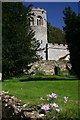
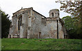

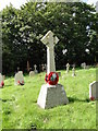
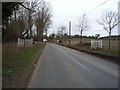
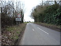
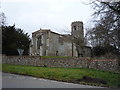
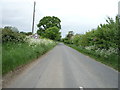
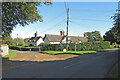
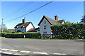
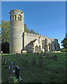
32 photos from this area
Area Information
Key information about the IP29 5LH including its size, population, and administrative classification.
- Area Type
- Postcode
- Area Size
- 96.6 hectares
- Population
- 2592
- Population Density
- 83 people/km²
House Prices in IP29 5LH
12
Properties
£862,250
Average Sold Price
£353,000
Lowest Price
£2,400,000
Highest Price
Showing 12 properties
| Address | Type | Beds | Baths | Last Sale Price | Last Sale Date | |
|---|---|---|---|---|---|---|
| The Old Rectory, Hargrave Road, Little Saxham, IP29 5LH | Detached | 6 | 5 | £2,400,000 | Jul 2023 | |
| By The Drift, Hargrave Road, Little Saxham, IP29 5LH | Detached | 4 | 2 | £645,000 | Jun 2021 | |
| Lawners House, Hargrave Road, Little Saxham, IP29 5LH | house | 4 | - | £665,000 | Oct 2015 | |
| Holly Lodge, Hargrave Road, Little Saxham, IP29 5LH | house | 4 | - | £625,000 | Aug 2012 | |
| Rectory Meadow, Hargrave Road, Little Saxham, IP29 5LH | Detached | 3 | 2 | £485,500 | Apr 2007 | |
| Smallwood House, Hargrave Road, Little Saxham, IP29 5LH | Detached | - | - | £353,000 | Oct 1999 | |
| Lodge Farm, Hargrave Road, Little Saxham, IP29 5LH | Detached | 4 | - | - | - | |
| Lawners Cottage, Hargrave Road, Little Saxham, IP29 5LH | Detached | - | - | - | - | |
| Flat, The Old Rectory, Hargrave Road, Little Saxham, IP29 5LH | Flat | - | - | - | - | |
| St Nicholas House, Hargrave Road, Little Saxham, IP29 5LH | house | - | - | - | - |
Page 1 of 2
Energy Efficiency in IP29 5LH
Amenities
Schools
| Rank | School | Type | Entry gender | Ages |
|---|
Explore more schools in this area
Go to Schools tabDemographics
Household Size
Two person
most common
Accommodation Type
Houses
most common
Tenure
72
majority
Ethnic Group
White
most common
Religion
N/A
most common
Household Composition
N/A
most common
Age
47
median
Adults (30-64 years)
most common
Household Deprivation
N/A
with no deprivation
NS-SEC
40
in Lower managerial occupations
Explore more demographic insights in this area
Go to Demographics tabPlanning
Planning Constraints
- Flood RiskPremium
- Ramsar Wetland SitesPremium
- Area of Outstanding Natural BeautyPremium
- Protected Nature ReservePremium
- Protected WoodlandPremium