Area Overview for IP29 5AE
Photos of IP29 5AE
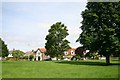
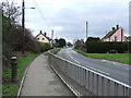
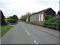
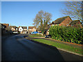
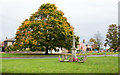
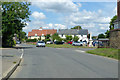
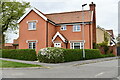
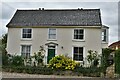
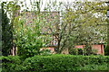
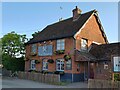
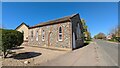
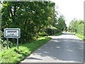
28 photos from this area
Area Information
Key information about the IP29 5AE including its size, population, and administrative classification.
- Area Type
- Postcode
- Area Size
- 5.8 hectares
- Population
- 2592
- Population Density
- 83 people/km²
House Prices in IP29 5AE
14
Properties
£248,940
Average Sold Price
£75,000
Lowest Price
£347,000
Highest Price
Showing 14 properties
| Address | Type | Beds | Baths | Last Sale Price | Last Sale Date | |
|---|---|---|---|---|---|---|
| 25 Bury Road, Barrow, IP29 5AE | Bungalow | 3 | 1 | £327,500 | Jul 2019 | |
| 21 Bury Road, Barrow, IP29 5AE | house | - | - | £317,000 | Oct 2013 | |
| The Gables, 19 Bury Road, Barrow, IP29 5AE | Detached | 4 | - | £250,000 | May 2013 | |
| Highbank, 23 Bury Road, Barrow, IP29 5AE | Bungalow | - | - | £239,950 | May 2011 | |
| 2, Feltons Barns, Bury Road, Barrow, IP29 5AE | house | - | - | £347,000 | Mar 2007 | |
| 22 Bury Road, Barrow, IP29 5AE | Bungalow | - | - | £222,000 | Feb 2007 | |
| 1, Feltons Barns, Bury Road, Barrow, IP29 5AE | house | - | - | £280,000 | Nov 2003 | |
| Maple Trees, Bury Road, Barrow, IP29 5AE | Detached | 4 | 3 | £180,950 | Sep 2003 | |
| Orchard Cottage, Bury Road, Barrow, IP29 5AE | Detached | - | - | £250,000 | Jun 2002 | |
| Waterford, 24 Bury Road, Barrow, IP29 5AE | Detached | - | - | £75,000 | Aug 1995 |
Page 1 of 2
Energy Efficiency in IP29 5AE
Amenities
Schools
| Rank | School | Type | Entry gender | Ages |
|---|
Explore more schools in this area
Go to Schools tabDemographics
Household Size
Two person
most common
Accommodation Type
Houses
most common
Tenure
72
majority
Ethnic Group
White
most common
Religion
N/A
most common
Household Composition
N/A
most common
Age
47
median
Adults (30-64 years)
most common
Household Deprivation
N/A
with no deprivation
NS-SEC
40
in Lower managerial occupations
Explore more demographic insights in this area
Go to Demographics tabPlanning
Planning Constraints
- Flood RiskPremium
- Ramsar Wetland SitesPremium
- Area of Outstanding Natural BeautyPremium
- Protected Nature ReservePremium
- Protected WoodlandPremium