Area Overview for IP29 5AA
Photos of IP29 5AA
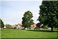
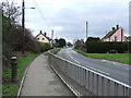
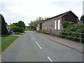
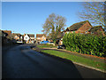
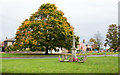
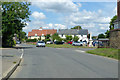
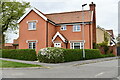
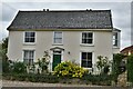
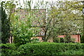
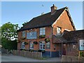
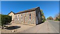
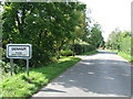
28 photos from this area
Area Information
Key information about the IP29 5AA including its size, population, and administrative classification.
- Area Type
- Postcode
- Area Size
- 3.3 hectares
- Population
- 2592
- Population Density
- 83 people/km²
House Prices in IP29 5AA
36
Properties
£249,187
Average Sold Price
£37,000
Lowest Price
£533,000
Highest Price
Showing 36 properties
| Address | Type | Beds | Baths | Last Sale Price | Last Sale Date | |
|---|---|---|---|---|---|---|
| Dalham House, 36 The Green, Barrow, IP29 5AA | house | - | - | £533,000 | Dec 2020 | |
| Dove Cottage, 38 The Green, Barrow, IP29 5AA | Cottage | 2 | 1 | £380,000 | Oct 2017 | |
| Avon House, 40-41 The Green, Barrow, IP29 5AA | house | 4 | - | £367,000 | May 2017 | |
| 46 The Green, Barrow, IP29 5AA | Detached | 4 | 2 | £384,995 | May 2015 | |
| 43 The Green, Barrow, IP29 5AA | house | - | - | £359,995 | Sep 2014 | |
| 45 The Green, Barrow, IP29 5AA | Semi-detached | 3 | 2 | £249,995 | Aug 2014 | |
| 33 The Green, Barrow, IP29 5AA | Cottage | 2 | 1 | £185,000 | Jul 2014 | |
| 30 The Green, Barrow, IP29 5AA | Terraced | 1 | 1 | £195,000 | Nov 2013 | |
| Farthing Cottage, 39 The Green, Barrow, IP29 5AA | house | 3 | 1 | £250,000 | Aug 2013 | |
| 28 The Green, Barrow, IP29 5AA | house | 5 | - | £197,500 | Nov 2012 |
Page 1 of 4
Energy Efficiency in IP29 5AA
Amenities
Schools
| Rank | School | Type | Entry gender | Ages |
|---|
Explore more schools in this area
Go to Schools tabDemographics
Household Size
Two person
most common
Accommodation Type
Houses
most common
Tenure
72
majority
Ethnic Group
White
most common
Religion
N/A
most common
Household Composition
N/A
most common
Age
47
median
Adults (30-64 years)
most common
Household Deprivation
N/A
with no deprivation
NS-SEC
40
in Lower managerial occupations
Explore more demographic insights in this area
Go to Demographics tabPlanning
Planning Constraints
- Flood RiskPremium
- Ramsar Wetland SitesPremium
- Area of Outstanding Natural BeautyPremium
- Protected Nature ReservePremium
- Protected WoodlandPremium