Area Overview for IP29 4RP
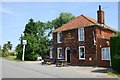
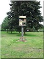
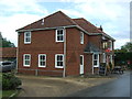
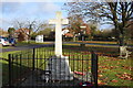
Photos of IP29 4RP


Area Information
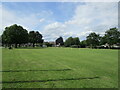
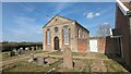
Living in IP29 4RP means being part of a small, tightly knit residential cluster in eastern England. With a population of 2,450 spread across a low-density area, the postcode reflects a quiet, family-oriented environment. The area’s modest size and sparse development suggest a focus on stability rather than rapid growth. Residents here are predominantly adults aged 30–64, many of whom own their homes, creating a community with a mature demographic profile. Daily life is shaped by proximity to local amenities, including retail outlets and rail connections, though the area’s compact nature means most needs are met within a short distance. The low flood risk and absence of environmental constraints like protected woodlands or Areas of Outstanding Natural Beauty contribute to a practical, unencumbered living experience. For those seeking a balance between rural tranquillity and accessible services, IP29 4RP offers a straightforward, no-frills lifestyle.
- Area Type
- Postcode
- Area Size
- Not available
- Population
- 2450
- Population Density
- 57 people/km²
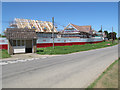
IP29 4RP is characterised by a strong owner-occupied market, with 71% of homes owned by residents rather than rented. The predominant accommodation type is houses, which is unusual for areas with higher population density. This suggests a focus on single-family homes, possibly with gardens, catering to families or individuals seeking private space. Given the area’s small size and limited housing stock, the property market is likely constrained, with fewer options for buyers compared to larger towns. The high home ownership rate implies a stable market with lower turnover, which could be appealing to those seeking long-term investment. However, the scarcity of rental properties may limit flexibility for those needing short-term housing. For buyers, the emphasis on houses means competition could be fierce, particularly for properties with specific features like proximity to schools or transport links.
House Prices in IP29 4RP
No properties found in this postcode.
Energy Efficiency in IP29 4RP
The lifestyle in IP29 4RP is defined by proximity to essential amenities within walking or short driving distance. Retail options include five notable venues, such as Morrisons Daily Bury and M&S West, offering a range of shopping and dining choices. The presence of multiple retail outlets suggests a modest but functional commercial hub, catering to daily needs without requiring long trips. Rail connectivity is robust, with four stations providing access to regional routes, which is particularly valuable for commuters. While the area lacks large-scale leisure facilities, the combination of shops, rail links, and nearby schools creates a self-contained environment. The convenience of these amenities supports a low-maintenance lifestyle, ideal for those prioritising practicality over extensive recreational options.
Amenities
Schools
Residents of IP29 4RP have access to three schools within practical reach. Rougham Church of England Voluntary Controlled Primary School and Rougham Church of England Primary School both offer primary education and hold Ofsted ratings of ‘good’. Sybil Andrews Academy, a secondary school, also has a ‘good’ Ofsted rating. This mix of primary and secondary education ensures families can access schooling from early years through adolescence without needing to travel far. The presence of two primary schools in the same area may indicate a focus on local provision, while the academy provides a broader curriculum. The ‘good’ ratings suggest consistent standards, though the absence of data on pupil outcomes or specific subjects means further details are unavailable. For parents, the proximity of these schools reduces commuting time and supports a balanced lifestyle.
| Rank | School | Type | Entry gender | Ages |
|---|
Explore more schools in this area
Go to Schools tabDemographics
The population of IP29 4RP is 2,450, with a median age of 47 and a majority of residents falling into the 30–64 age range. This suggests a community skewed towards middle-aged adults, likely including families and long-term residents. Home ownership is high, at 71%, with the predominant accommodation type being houses rather than flats or apartments. The dominant ethnic group is White, which aligns with broader regional trends. The age profile indicates a stable, mature population with fewer young dependents or elderly residents compared to other areas. This demographic mix may influence local services and amenities, which appear tailored to established households rather than transient populations. The absence of specific deprivation data means the quality of life remains unquantified, but the low crime risk and lack of environmental restrictions suggest a relatively untroubled living environment.
Household Size
Accommodation Type
Tenure
Ethnic Group
Religion
Household Composition
Age
Household Deprivation
NS-SEC
Explore more demographic insights in this area
Go to Demographics tabPlanning
Planning Constraints
- Flood RiskPremium
- Ramsar Wetland SitesPremium
- Area of Outstanding Natural BeautyPremium
- Protected Nature ReservePremium
- Protected WoodlandPremium