Area Overview for IP29 4QQ
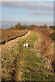
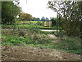
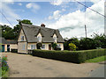
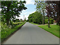
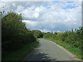
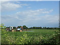
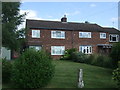
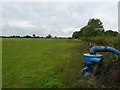
Photos of IP29 4QQ
Area Information
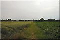
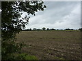
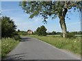
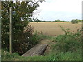
Living in IP29 4QQ means being part of a small, tightly knit residential cluster in eastern England. With a population of 2106 spread over a low-density area of just over 40 square kilometres, this postcode embodies a quiet, rural lifestyle. The community here is predominantly middle-aged, with a median age of 47 and most residents falling between 30 and 64 years old. This demographic suggests a stable, long-term presence, with 80% of homes owner-occupied. The area’s compact size means neighbours are close, and daily life is shaped by local routines rather than urban bustle. Safety is a key feature: the area scores 96 out of 100 for low crime risk, making it one of the safer places to live. While there are no major towns nearby, the proximity to villages like Lavenham offers access to essential services without compromising the peace of a rural setting. For those seeking a slower pace with strong community ties, IP29 4QQ provides a foundation of security, simplicity, and a sense of continuity.
- Area Type
- Postcode
- Area Size
- Not available
- Population
- 2106
- Population Density
- 51 people/km²
The property market in IP29 4QQ is defined by high home ownership (80%) and a focus on houses rather than flats, indicating a traditional, family-oriented housing stock. As a small postcode area, the number of available properties is limited, which may make the market competitive for buyers. The predominance of owner-occupied homes suggests a long-term presence of residents, with fewer rental properties available. This dynamic is typical of rural areas where housing is often inherited or purchased for long-term stability. For buyers, the small size of the area means proximity to nearby villages like Lavenham is crucial, as local amenities are sparse. The lack of high-density housing also means properties here are likely to be larger, with more land. However, the limited inventory could mean that those seeking to buy in IP29 4QQ need to act quickly and consider nearby postcodes for additional options.
House Prices in IP29 4QQ
No properties found in this postcode.
Energy Efficiency in IP29 4QQ
The lifestyle in IP29 4QQ is shaped by its rural setting and proximity to nearby villages. Within practical reach are five retail venues, including Co-op Lavenham, East of England Co-operative Co, and Spar, offering essential shopping options. These stores provide access to groceries, household goods, and basic services, though the selection is limited compared to larger towns. The low population density means that leisure and dining options are sparse, with most social activities likely centred around local pubs or community events in nearby villages. The absence of detailed data on parks or recreational facilities means that outdoor activities may require travel to larger settlements. However, the area’s quiet, low-traffic environment is ideal for those who prioritise peace and a slower pace of life. The combination of basic amenities and a rural backdrop makes IP29 4QQ suitable for those who value simplicity and self-sufficiency.
Amenities
Schools
Residents of IP29 4QQ have access to three primary schools, all within practical reach. Hartest Church of England Voluntary Controlled Primary School and Hartest Church of England Primary School serve the area, with the latter rated ‘good’ by Ofsted. A short distance away, All Saints’ Church of England Voluntary Controlled Primary School in Lawshall holds an ‘outstanding’ rating, making it a notable option for families. The presence of multiple primary schools ensures that children have several choices, though the area’s small size means these schools likely serve a broader region. The mix of school types—two church-affiliated institutions—suggests a community with varied educational preferences. For families prioritising high-quality education, the ‘outstanding’ rating at All Saints’ is a strong indicator, while the other schools provide reliable alternatives. The proximity of these schools to homes in IP29 4QQ reinforces the area’s appeal for families seeking a settled, school-friendly environment.
| Rank | School | Type | Entry gender | Ages |
|---|
Explore more schools in this area
Go to Schools tabDemographics
The population of IP29 4QQ is 2106, with a density of 51 people per square kilometre, reflecting a sparse, rural character. The median age of 47 indicates a mature community, with the largest age group being adults aged 30–64. This suggests a stable population with fewer young families, though the presence of three primary schools nearby hints at some household diversity. Home ownership is high at 80%, with most properties being houses rather than flats, pointing to a traditional, family-oriented housing stock. The predominant ethnic group is White, aligning with broader regional trends. The low population density means residents enjoy more private space, though it also limits the scale of local amenities. For those prioritising security and a settled environment, the demographic profile of IP29 4QQ offers a predictable, low-stress lifestyle. However, the absence of specific data on deprivation or income levels means the area’s economic diversity remains unexplored.
Household Size
Accommodation Type
Tenure
Ethnic Group
Religion
Household Composition
Age
Household Deprivation
NS-SEC
Explore more demographic insights in this area
Go to Demographics tabPlanning
Planning Constraints
- Flood RiskPremium
- Ramsar Wetland SitesPremium
- Area of Outstanding Natural BeautyPremium
- Protected Nature ReservePremium
- Protected WoodlandPremium