Area Overview for IP29 4DJ
Photos of IP29 4DJ
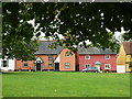
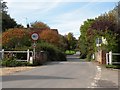
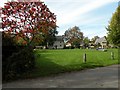
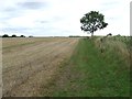
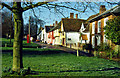
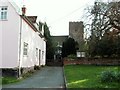
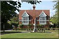
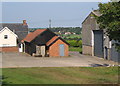
100 photos from this area
Area Information
Key information about the IP29 4DJ including its size, population, and administrative classification.
- Area Type
- Postcode
- Area Size
- 6.9 hectares
- Population
- 2106
- Population Density
- 51 people/km²
House Prices in IP29 4DJ
30
Properties
£338,708
Average Sold Price
£59,500
Lowest Price
£600,000
Highest Price
Showing 30 properties
| Address | Type | Beds | Baths | Last Sale Price | Last Sale Date | |
|---|---|---|---|---|---|---|
| Thatched Cottage, The Row, Hartest, IP29 4DJ | Detached | - | - | £455,000 | Dec 2023 | |
| New House, The Row, Hartest, IP29 4DJ | Detached | 5 | 1 | £430,000 | Sep 2023 | |
| Tebbit, The Row, Hartest, IP29 4DJ | house | - | - | £350,000 | Aug 2021 | |
| Brookside Cottage, The Row, Hartest, IP29 4DJ | Detached | 4 | - | £425,000 | Dec 2016 | |
| Poplar House, The Row, Hartest, IP29 4DJ | Detached | 4 | 2 | £425,000 | Jul 2016 | |
| Barham Cottage, The Row, Hartest, IP29 4DJ | Detached | 2 | - | £215,000 | Oct 2014 | |
| Casa Nostra, The Row, Hartest, IP29 4DJ | Bungalow | 4 | 2 | £294,000 | Oct 2013 | |
| Touchstones, The Row, Hartest, IP29 4DJ | house | 4 | - | £283,000 | Jan 2013 | |
| The Copse, The Row, Hartest, IP29 4DJ | Detached | - | - | £600,000 | Feb 2007 | |
| Ty Pegs, The Row, Hartest, IP29 4DJ | Detached | - | - | £278,000 | Oct 2005 |
Page 1 of 3
Energy Efficiency in IP29 4DJ
Amenities
Schools
| Rank | School | Type | Entry gender | Ages |
|---|
Explore more schools in this area
Go to Schools tabDemographics
Household Size
Two person
most common
Accommodation Type
Houses
most common
Tenure
80
majority
Ethnic Group
White
most common
Religion
N/A
most common
Household Composition
N/A
most common
Age
47
median
Adults (30-64 years)
most common
Household Deprivation
N/A
with no deprivation
NS-SEC
39
in Lower managerial occupations
Explore more demographic insights in this area
Go to Demographics tabPlanning
Planning Constraints
- Flood RiskPremium
- Ramsar Wetland SitesPremium
- Area of Outstanding Natural BeautyPremium
- Protected Nature ReservePremium
- Protected WoodlandPremium