Area Overview for IP28 9BQ
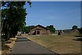
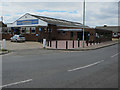
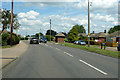
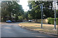
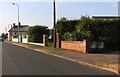
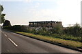
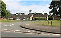
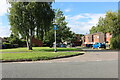
Photos of IP28 9BQ


Area Information
IP28 9BQ is a small, residential postcode area in England, home to around 1323 people. It is a compact cluster of homes, typically set in a quieter, more established setting. The area’s population reflects a mature demographic, with a median age of 47 and a strong presence of adults aged 30–64. This suggests a community rooted in stability, with many residents likely to be long-term residents or families with established routines. Living here offers a blend of practicality and proximity to essential services, including schools, retail, and transport links. The area is not densely populated, which may appeal to those seeking a less congested environment. While it lacks the vibrancy of larger towns, its small size fosters a sense of familiarity. Residents are likely to value the balance between accessibility to nearby amenities and the relative tranquillity of a smaller community. The area’s character is defined by its housing stock, which is predominantly houses, and its proximity to RAF bases, which may influence local employment and demographics.
- Area Type
- Postcode
- Area Size
- Not available
- Population
- 1323
- Population Density
- 1345 people/km²
The property market in IP28 9BQ is shaped by its small size and the prevalence of houses. With 52% of homes owner-occupied, the area is not heavily reliant on rentals, though the remaining 48% likely includes private rentals and other tenure types. The housing stock is predominantly detached or semi-detached homes, which may appeal to buyers seeking traditional family homes. However, the small scale of the area means the number of available properties is limited, potentially making the market competitive for buyers. The presence of RAF bases nearby could influence local property values, though this is not quantified in the data. For those considering purchase, the area’s compact nature means proximity to amenities like schools and transport is a key factor. Buyers should also consider the practicality of the housing stock, which may not cater to those seeking modern or high-density living.
House Prices in IP28 9BQ
No properties found in this postcode.
Energy Efficiency in IP28 9BQ
Living in IP28 9BQ offers access to practical amenities within reach, including five retail outlets such as Morrisons Daily Mildenhall ST and Heron Mildenhall, providing everyday shopping needs. The area’s proximity to RAF bases may also mean a range of services catering to military personnel and their families. For leisure, the nearby airports and rail station offer travel opportunities, though the area itself lacks detailed information on parks or recreational spaces. The presence of multiple schools and transport links suggests a focus on functionality over leisure. Residents may find the area convenient for those prioritising accessibility to essential services, though the small scale means there is limited scope for cultural or social amenities beyond the basics. The retail options are sufficient for daily needs, but those seeking a broader range of entertainment or dining may need to travel further afield.
Amenities
Schools
The schools near IP28 9BQ include Great Heath Primary School and College Heath Middle School, both of which are primary institutions. For secondary education, St Mary’s Church of England Academy and Great Heath Academy are available, with the latter holding an Ofsted rating of ‘good’. St Mary’s has a ‘satisfactory’ rating, which suggests it meets minimum standards but may lack outstanding features. The mix of primary and academy schools offers families a choice between traditional state schools and academies, which often have more autonomy in curriculum and governance. While the Ofsted ratings indicate a moderate to good standard of education, parents may want to visit schools to assess their suitability for their children’s needs. The presence of two academies and two primary schools suggests a reasonably comprehensive educational offering for the area’s population.
| Rank | School | Type | Entry gender | Ages |
|---|---|---|---|---|
| 1 | Great Heath Primary School | primary | N/A | N/A |
| 2 | College Heath Middle School | primary | N/A | N/A |
| 3 | St Mary's Church of England Academy | academy | N/A | N/A |
| 4 | Great Heath Academy | academy | N/A | N/A |
Explore more schools in this area
Go to Schools tabDemographics
The community in IP28 9BQ is predominantly composed of adults aged 30–64, with a median age of 47. This suggests a mature population, likely with established careers and families. Home ownership stands at 52%, indicating a mix of owner-occupied properties and rental homes. The area is characterised by houses rather than flats, which aligns with its more traditional, suburban feel. The predominant ethnic group is White, which is consistent with the broader demographic patterns in rural and semi-rural England. The absence of specific data on deprivation or diversity means the area’s social composition is not extensively detailed, but the age and ownership figures imply a stable, middle-aged population. For families, this could mean a community with a focus on long-term living, though the limited data does not confirm whether the area has a strong sense of local identity or social cohesion.
Household Size
Accommodation Type
Tenure
Ethnic Group
Religion
Household Composition
Age
Household Deprivation
NS-SEC
Explore more demographic insights in this area
Go to Demographics tabPlanning
Planning Constraints
- Flood RiskPremium
- Ramsar Wetland SitesPremium
- Area of Outstanding Natural BeautyPremium
- Protected Nature ReservePremium
- Protected WoodlandPremium
- Crime RiskPremium