Area Overview for IP28 8TN
Photos of IP28 8TN
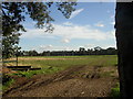
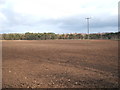
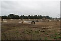
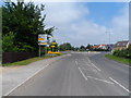
13 photos from this area
Area Information
Key information about the IP28 8TN including its size, population, and administrative classification.
- Area Type
- Postcode
- Area Size
- 6999 m²
- Population
- 1663
- Population Density
- 176 people/km²
House Prices in IP28 8TN
20
Properties
£131,299
Average Sold Price
£44,000
Lowest Price
£240,000
Highest Price
Showing 20 properties
| Address | Type | Beds | Baths | Last Sale Price | Last Sale Date | |
|---|---|---|---|---|---|---|
| 12 Carnation Way, Red Lodge, IP28 8TN | Terraced | 3 | 1 | £224,000 | Jul 2024 | |
| 5 Carnation Way, Red Lodge, IP28 8TN | Terraced | 3 | 1 | £240,000 | Jul 2023 | |
| 4 Carnation Way, Red Lodge, IP28 8TN | house | - | - | £230,000 | Feb 2022 | |
| 9 Carnation Way, Red Lodge, IP28 8TN | house | - | - | £175,000 | Oct 2018 | |
| 17 Carnation Way, Red Lodge, IP28 8TN | Terraced | 3 | - | £164,000 | Feb 2017 | |
| 15 Carnation Way, Red Lodge, IP28 8TN | Terraced | 3 | 1 | £133,500 | Aug 2014 | |
| 10 Carnation Way, Red Lodge, IP28 8TN | Terraced | - | - | £107,000 | Jul 2005 | |
| 11 Carnation Way, Red Lodge, IP28 8TN | Terraced | 2 | 2 | £105,000 | Apr 2005 | |
| 13 Carnation Way, Red Lodge, IP28 8TN | house | - | - | £110,000 | Mar 2005 | |
| 8 Carnation Way, Red Lodge, IP28 8TN | Terraced | 3 | 1 | £116,000 | May 2004 |
Page 1 of 2
Energy Efficiency in IP28 8TN
Amenities
Schools
| Rank | School | Type | Entry gender | Ages |
|---|
Explore more schools in this area
Go to Schools tabDemographics
Household Size
Two person
most common
Accommodation Type
Houses
most common
Tenure
53
majority
Ethnic Group
White
most common
Religion
N/A
most common
Household Composition
N/A
most common
Age
47
median
Adults (30-64 years)
most common
Household Deprivation
N/A
with no deprivation
NS-SEC
31
in Lower managerial occupations
Explore more demographic insights in this area
Go to Demographics tabPlanning
Planning Constraints
- Flood RiskPremium
- Ramsar Wetland SitesPremium
- Area of Outstanding Natural BeautyPremium
- Protected Nature ReservePremium
- Protected WoodlandPremium