Area Overview for IP28 8NT
Photos of IP28 8NT


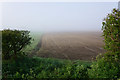
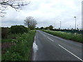
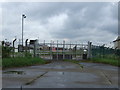
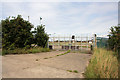

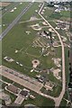
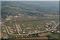


11 photos from this area
Area Information
Key information about the IP28 8NT including its size, population, and administrative classification.
- Area Type
- Postcode
- Area Size
- 2.2 km²
- Population
- 2196
- Population Density
- 440 people/km²
House Prices in IP28 8NT
6
Properties
£96,000
Average Sold Price
£95,000
Lowest Price
£97,000
Highest Price
Showing 6 properties
| Address | Type | Beds | Baths | Last Sale Price | Last Sale Date | |
|---|---|---|---|---|---|---|
| Astra Villa, Mildenhall Road, West Row, IP28 8NT | Land | - | - | £95,000 | May 2000 | |
| New House, Mildenhall Road, West Row, IP28 8NT | Detached | - | - | £97,000 | Feb 2000 | |
| Dwelling, Alwyn Moss Ltd, Mildenhall Road, West Row, IP28 8NT | Detached | - | - | - | - | |
| Annexe, Sun Villa, Mildenhall Road, West Row, IP28 8NT | Flat | - | - | - | - | |
| Hammetts Farm, Mildenhall Road, West Row, IP28 8NT | house | - | - | - | - | |
| Plantation Farm, Chapel Road, West Row, IP28 8NT | house | - | - | - | - |
Energy Efficiency in IP28 8NT
Amenities
Schools
| Rank | School | Type | Entry gender | Ages |
|---|
Explore more schools in this area
Go to Schools tabDemographics
Household Size
Family (3-5 people)
most common
Accommodation Type
Houses
most common
Tenure
35
majority
Ethnic Group
White
most common
Religion
N/A
most common
Household Composition
N/A
most common
Age
22
median
Young Adults (15-29 years)
most common
Household Deprivation
N/A
with no deprivation
NS-SEC
34
in Lower managerial occupations
Explore more demographic insights in this area
Go to Demographics tabPlanning
Planning Constraints
- Flood RiskPremium
- Ramsar Wetland SitesPremium
- Area of Outstanding Natural BeautyPremium
- Protected Nature ReservePremium
- Protected WoodlandPremium