Area Overview for IP28 8HY
Photos of IP28 8HY
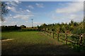
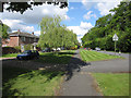
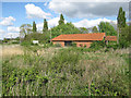
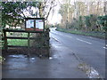
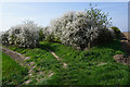
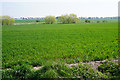
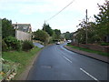
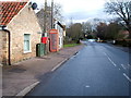
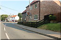

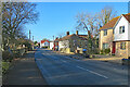
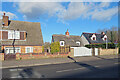
27 photos from this area
Area Information
Key information about the IP28 8HY including its size, population, and administrative classification.
- Area Type
- Postcode
- Area Size
- 14.8 hectares
- Population
- 2334
- Population Density
- 98 people/km²
House Prices in IP28 8HY
18
Properties
£318,850
Average Sold Price
£22,500
Lowest Price
£965,000
Highest Price
Showing 18 properties
| Address | Type | Beds | Baths | Last Sale Price | Last Sale Date | |
|---|---|---|---|---|---|---|
| 6 North Street, Freckenham, IP28 8HY | Bungalow | 2 | 1 | £215,000 | Jun 2024 | |
| 22 North Street, Freckenham, IP28 8HY | Bungalow | 3 | 1 | £22,500 | Feb 2022 | |
| 12 North Street, Freckenham, IP28 8HY | Semi-detached | 2 | 2 | £225,000 | Aug 2019 | |
| Lavrock House, North Street, Freckenham, IP28 8HY | house | - | - | £965,000 | Oct 2018 | |
| Lane End, North Street, Freckenham, IP28 8HY | Detached | 4 | - | £460,000 | Jul 2013 | |
| Brooklands, North Street, Freckenham, IP28 8HY | Detached | 5 | - | £535,000 | Jul 2013 | |
| 10 North Street, Freckenham, IP28 8HY | Semi-detached | - | - | £120,000 | Jul 2007 | |
| 18 North Street, Freckenham, IP28 8HY | Bungalow | 2 | 1 | £121,000 | Nov 2004 | |
| Wellington House, North Street, Freckenham, IP28 8HY | Detached | - | - | £250,000 | Apr 2000 | |
| Street Farm, North Street, Freckenham, IP28 8HY | Detached | - | - | £275,000 | Jan 1997 |
Page 1 of 2
Energy Efficiency in IP28 8HY
Amenities
Schools
| Rank | School | Type | Entry gender | Ages |
|---|
Explore more schools in this area
Go to Schools tabDemographics
Household Size
Two person
most common
Accommodation Type
Houses
most common
Tenure
73
majority
Ethnic Group
White
most common
Religion
N/A
most common
Household Composition
N/A
most common
Age
47
median
Adults (30-64 years)
most common
Household Deprivation
N/A
with no deprivation
NS-SEC
39
in Lower managerial occupations
Explore more demographic insights in this area
Go to Demographics tabPlanning
Planning Constraints
- Flood RiskPremium
- Ramsar Wetland SitesPremium
- Area of Outstanding Natural BeautyPremium
- Protected Nature ReservePremium
- Protected WoodlandPremium