Area Overview for IP28 8EB
Photos of IP28 8EB

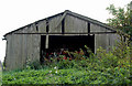
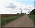

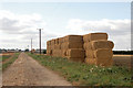
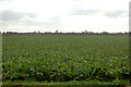
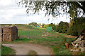

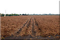
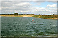
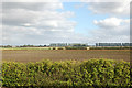
21 photos from this area
Area Information
Key information about the IP28 8EB including its size, population, and administrative classification.
- Area Type
- Postcode
- Area Size
- 4.9 km²
- Population
- 1224
- Population Density
- 57 people/km²
House Prices in IP28 8EB
16
Properties
£1,524,167
Average Sold Price
£200,000
Lowest Price
£3,975,000
Highest Price
Showing 16 properties
| Address | Type | Beds | Baths | Last Sale Price | Last Sale Date | |
|---|---|---|---|---|---|---|
| Foleigh, Burnt Fen Turnpike, Burnt Fen, IP28 8EB | Bungalow | - | - | £397,500 | Sep 2020 | |
| Townmore Farm, Burnt Fen Turnpike, Burnt Fen, IP28 8EB | Bungalow | - | - | £3,975,000 | Sep 2013 | |
| The Chestnuts, Burnt Fen Turnpike, Burnt Fen, IP28 8EB | Bungalow | - | - | £200,000 | Aug 2013 | |
| Caravan 3, Harris Farm, Burnt Fen Turnpike, Burnt Fen, IP28 8EB | Mobile Home | - | - | - | - | |
| Caravan 2, Harris Farm, Burnt Fen Turnpike, Burnt Fen, IP28 8EB | Mobile Home | - | - | - | - | |
| Caravan 1, Harris Farm, Burnt Fen Turnpike, Burnt Fen, IP28 8EB | Mobile Home | - | - | - | - | |
| Woodcock Engineering Ltd, Kenny Hill Builders Merchants, Kenny Hill Service Station Ltd, Burnt Fen Turnpike, Burnt Fen, IP28 8EB | Industrial | - | - | - | - | |
| Caravan 5, Harris Farm, Burnt Fen Turnpike, Burnt Fen, IP28 8EB | Mobile Home | - | - | - | - | |
| Caravan 4, Harris Farm, Burnt Fen Turnpike, Burnt Fen, IP28 8EB | Mobile Home | - | - | - | - | |
| Underground Storage Tank, Kenny Hill Service Station Ltd, Burnt Fen Turnpike, Burnt Fen, IP28 8EB | warehouse | - | - | - | - |
Page 1 of 2
Energy Efficiency in IP28 8EB
Amenities
Schools
| Rank | School | Type | Entry gender | Ages |
|---|
Explore more schools in this area
Go to Schools tabDemographics
Household Size
Two person
most common
Accommodation Type
Houses
most common
Tenure
63
majority
Ethnic Group
White
most common
Religion
N/A
most common
Household Composition
N/A
most common
Age
47
median
Adults (30-64 years)
most common
Household Deprivation
N/A
with no deprivation
NS-SEC
30
in Lower managerial occupations
Explore more demographic insights in this area
Go to Demographics tabPlanning
Planning Constraints
- Flood RiskPremium
- Ramsar Wetland SitesPremium
- Area of Outstanding Natural BeautyPremium
- Protected Nature ReservePremium
- Protected WoodlandPremium