Area Overview for IP28 7PY
Photos of IP28 7PY

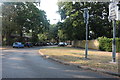
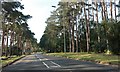
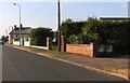
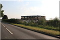
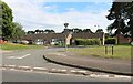
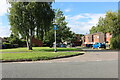
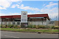
21 photos from this area
Area Information
Key information about the IP28 7PY including its size, population, and administrative classification.
- Area Type
- Postcode
- Area Size
- 2.0 hectares
- Population
- 1323
- Population Density
- 1345 people/km²
House Prices in IP28 7PY
35
Properties
£105,250
Average Sold Price
£67,500
Lowest Price
£138,000
Highest Price
Showing 35 properties
| Address | Type | Beds | Baths | Last Sale Price | Last Sale Date | |
|---|---|---|---|---|---|---|
| 13 Gonville Close, Mildenhall, IP28 7PY | Flat | 1 | 1 | £122,500 | Dec 2025 | |
| 6 Gonville Close, Mildenhall, IP28 7PY | Flat | - | - | £138,000 | Nov 2024 | |
| 32 Gonville Close, Mildenhall, IP28 7PY | Flat | 1 | 1 | £113,000 | Jul 2019 | |
| 3 Gonville Close, Mildenhall, IP28 7PY | Bungalow | 3 | - | £113,500 | Jun 2005 | |
| 20 Gonville Close, Mildenhall, IP28 7PY | Flat | 1 | 1 | £77,000 | Aug 2004 | |
| 31 Gonville Close, Mildenhall, IP28 7PY | Flat | - | - | £67,500 | Nov 2003 | |
| 9 Gonville Close, Mildenhall, IP28 7PY | Flat | - | - | - | - | |
| 12 Gonville Close, Mildenhall, IP28 7PY | Flat | - | - | - | - | |
| 2 Gonville Close, Mildenhall, IP28 7PY | Flat | - | - | - | - | |
| 18 Gonville Close, Mildenhall, IP28 7PY | Flat | - | - | - | - |
Page 1 of 4
Energy Efficiency in IP28 7PY
Amenities
Schools
| Rank | School | Type | Entry gender | Ages |
|---|
Explore more schools in this area
Go to Schools tabDemographics
Household Size
Two person
most common
Accommodation Type
Houses
most common
Tenure
52
majority
Ethnic Group
White
most common
Religion
N/A
most common
Household Composition
N/A
most common
Age
47
median
Adults (30-64 years)
most common
Household Deprivation
N/A
with no deprivation
NS-SEC
24
in Lower managerial occupations
Explore more demographic insights in this area
Go to Demographics tabPlanning
Planning Constraints
- Flood RiskPremium
- Ramsar Wetland SitesPremium
- Area of Outstanding Natural BeautyPremium
- Protected Nature ReservePremium
- Protected WoodlandPremium