Area Overview for IP28 7FF
Photos of IP28 7FF
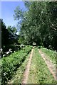
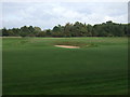
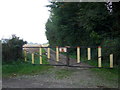
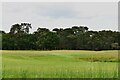
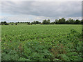
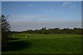
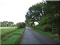
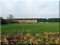
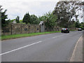
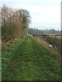
10 photos from this area
Area Information
Key information about the IP28 7FF including its size, population, and administrative classification.
- Area Type
- Postcode
- Area Size
- 5.1 hectares
- Population
- 2334
- Population Density
- 98 people/km²
House Prices in IP28 7FF
71
Properties
£211,423
Average Sold Price
£62,500
Lowest Price
£325,000
Highest Price
Showing 71 properties
| Address | Type | Beds | Baths | Last Sale Price | Last Sale Date | |
|---|---|---|---|---|---|---|
| 94 Bridge Farm Close, Barton Mills, IP28 7FF | Semi-detached | 4 | - | £299,000 | May 2021 | |
| 8 Bridge Farm Close, Barton Mills, IP28 7FF | Flat | 2 | 2 | £134,000 | Apr 2019 | |
| 12 Bridge Farm Close, Barton Mills, IP28 7FF | Flat | - | - | £156,500 | Aug 2017 | |
| 44 Bridge Farm Close, Barton Mills, IP28 7FF | Flat | - | - | £62,500 | Oct 2016 | |
| 5 Bridge Farm Close, Barton Mills, IP28 7FF | house | - | - | £325,000 | Aug 2016 | |
| 82 Bridge Farm Close, Barton Mills, IP28 7FF | Terraced | 3 | 2 | £186,000 | Jul 2016 | |
| 2 Bridge Farm Close, Barton Mills, IP28 7FF | Flat | 2 | 1 | £119,000 | Jan 2016 | |
| 20 Bridge Farm Close, Barton Mills, IP28 7FF | Flat | - | - | £90,000 | Sep 2011 | |
| 70 Bridge Farm Close, Barton Mills, IP28 7FF | Detached | 4 | 3 | £215,000 | May 2011 | |
| 72 Bridge Farm Close, Barton Mills, IP28 7FF | house | 4 | - | £220,000 | May 2011 |
Page 1 of 8
Energy Efficiency in IP28 7FF
Amenities
Schools
| Rank | School | Type | Entry gender | Ages |
|---|
Explore more schools in this area
Go to Schools tabDemographics
Household Size
Two person
most common
Accommodation Type
Houses
most common
Tenure
73
majority
Ethnic Group
White
most common
Religion
N/A
most common
Household Composition
N/A
most common
Age
47
median
Adults (30-64 years)
most common
Household Deprivation
N/A
with no deprivation
NS-SEC
39
in Lower managerial occupations
Explore more demographic insights in this area
Go to Demographics tabPlanning
Planning Constraints
- Flood RiskPremium
- Ramsar Wetland SitesPremium
- Area of Outstanding Natural BeautyPremium
- Protected Nature ReservePremium
- Protected WoodlandPremium