Area Overview for IP28 7AW
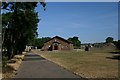
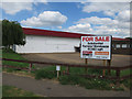
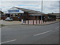
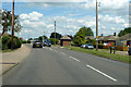
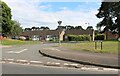
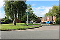
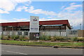
Photos of IP28 7AW

Area Information
Living in IP28 7AW means being part of a tightly packed residential cluster in England, where 1,323 people reside across just 3,256 square metres. The area’s high population density—406,285 people per square kilometre—reflects its compact nature, creating a close-knit community feel. With a median age of 47 and a majority of residents aged 30–64, the area is home to a stable, mature population. Most properties are owner-occupied, with 52% of homes owned outright, and the accommodation is predominantly houses rather than flats. Proximity to Great Heath Primary School, College Heath Middle School, and two academies offers families a range of educational options. Nearby, RAF Mildenhall and RAF Lakenheath provide easy access to military facilities, while Kennett Railway Station connects to broader transport networks. However, the area’s small size means amenities are limited to immediate surroundings, and broadband quality is modest, though mobile coverage is strong. For buyers, IP28 7AW balances practicality with a quiet, community-oriented lifestyle.
- Area Type
- Postcode
- Area Size
- 3256 m²
- Population
- 1323
- Population Density
- 1345 people/km²
IP28 7AW’s property market is characterised by a 52% home ownership rate, with the majority of properties being houses rather than flats. This suggests a focus on family-friendly, owner-occupied homes in a small, residential area. The compact size of the postcode means the housing stock is limited, and competition for properties may be high. Buyers should consider that the area’s small footprint restricts development options, and the proximity to military bases may influence property values. For those seeking rental options, the data does not indicate a strong rental market, implying most properties are held by long-term owners. Given the area’s size, buyers should explore nearby zones for additional choices, though the immediate surroundings may offer limited alternatives.
House Prices in IP28 7AW
No properties found in this postcode.
Energy Efficiency in IP28 7AW
The lifestyle in IP28 7AW is shaped by its proximity to retail, transport, and military hubs. Five notable retail outlets, including Morrisons Daily Mildenhall ST and Heron Mildenhall, provide everyday shopping options within reach. The presence of RAF Mildenhall and RAF Lakenheath adds a unique character, offering employment opportunities and a sense of community tied to military life. Kennett Railway Station connects residents to regional travel, though the area lacks extensive leisure or recreational facilities. The compact nature of the postcode means amenities are concentrated, making daily life convenient for those prioritising practicality over expansive leisure options. The mix of retail, transport, and military infrastructure defines a lifestyle that is functional and community-focused.
Amenities
Schools
Residents of IP28 7AW have access to a range of schools, including Great Heath Primary School and College Heath Middle School, both of which are primary institutions. For secondary education, St Mary’s Church of England Academy and Great Heath Academy are available, with the latter holding a ‘good’ Ofsted rating. St Mary’s has a ‘satisfactory’ rating, indicating it meets baseline standards but may have room for improvement. The mix of primary and academy schools offers families flexibility, though the absence of secondary schools within the postcode itself means students may need to travel. This could be a consideration for families prioritising proximity to schools. The overall quality of education appears mixed, with at least one institution performing above average.
| Rank | School | Type | Entry gender | Ages |
|---|
Explore more schools in this area
Go to Schools tabDemographics
The population of IP28 7AW is predominantly adults aged 30–64, with a median age of 47, indicating a mature, established community. Home ownership stands at 52%, suggesting a mix of long-term residents and those seeking stable housing. The area’s accommodation is largely houses, reflecting a preference for family homes over flats. The predominant ethnic group is White, though no specific data on diversity or deprivation is provided. The high population density—406,285 people per square kilometre—means living spaces are closely packed, which could influence social dynamics and property availability. With no data on income levels or deprivation, it’s unclear how this affects quality of life, but the age profile suggests a community focused on stability and family life.
Household Size
Accommodation Type
Tenure
Ethnic Group
Religion
Household Composition
Age
Household Deprivation
NS-SEC
Explore more demographic insights in this area
Go to Demographics tabPlanning
Planning Constraints
- Flood RiskPremium
- Ramsar Wetland SitesPremium
- Area of Outstanding Natural BeautyPremium
- Protected Nature ReservePremium
- Protected WoodlandPremium