Area Overview for IP28 6XJ
Photos of IP28 6XJ


Area Information
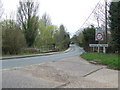
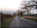
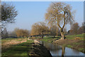
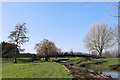
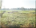
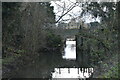
Living in IP28 6XJ offers a quiet, residential experience with a small population of 1,639 spread across a low-density area. This postcode is a compact cluster of homes, ideal for those seeking a slower pace of life. The area’s proximity to Bury St Edmunds and nearby towns ensures easy access to services without the congestion of larger urban centres. Daily life here is characterised by a mix of local shops, rail links, and open spaces, making it suitable for commuters and those who value convenience. With a population density of 196 people per square kilometre, the community feels intimate, and the area’s safety profile—backed by a crime score of 86—adds to its appeal. Residents benefit from a well-connected transport network, including four rail stations within reach, and the nearby RAF Honington airport provides additional travel options. The area’s low flood risk and absence of environmental constraints like AONB or protected woodlands make it a practical choice for homebuyers seeking stability.
- Area Type
- Postcode
- Area Size
- Not available
- Population
- 1639
- Population Density
- 196 people/km²
The property market in IP28 6XJ is dominated by owner-occupied homes, with 73% of properties in private hands. This suggests a stable market with little reliance on rental demand, which is uncommon in smaller postcode areas. The prevalence of houses over flats or apartments indicates a focus on family-friendly or long-term living, typical of suburban or semi-rural locations. Buyers in this area may find limited scope for investment in rental properties, as the market is driven by local residents rather than transient populations. The small size of the postcode means the housing stock is likely uniform, with limited variation in property types. For those seeking a quiet, established home, IP28 6XJ offers a straightforward market, though its compact nature may limit choices for buyers looking for specific features or larger developments.
House Prices in IP28 6XJ
No properties found in this postcode.
Energy Efficiency in IP28 6XJ
Residents of IP28 6XJ have access to a range of local amenities within practical reach. Retail options include Spar, Tesco Bury, and Asda Bury, providing everyday shopping needs. The area’s rail stations—such as Bury St Edmunds and Thurston—offer regular services to nearby towns, enhancing mobility. While the data does not mention parks or leisure facilities, the absence of environmental constraints like AONB or protected woodlands suggests open spaces may be available nearby. The small-town character of the area, combined with its retail and transport links, creates a convenient lifestyle for those who prefer a mix of local convenience and easy access to larger services. The presence of an airport, though primarily military, adds to the area’s strategic connectivity.
Amenities
Schools
| Rank | School | Type | Entry gender | Ages |
|---|
Explore more schools in this area
Go to Schools tabDemographics
The community in IP28 6XJ is predominantly composed of adults aged 30–64, with a median age of 47. This suggests a mature, settled population, likely with established careers and families. Home ownership is high at 73%, indicating a strong presence of long-term residents. The area is largely composed of houses, reflecting a traditional housing stock rather than flats or apartments. The predominant ethnic group is White, with no data provided on other demographics. The age profile and home ownership rates suggest a stable, low-turnover community. The absence of specific data on deprivation or diversity means the area’s social fabric remains largely unexplored in public records, but the demographic profile points to a cohesive, middle-aged population with a focus on homeownership.
Household Size
Accommodation Type
Tenure
Ethnic Group
Religion
Household Composition
Age
Household Deprivation
NS-SEC
Explore more demographic insights in this area
Go to Demographics tabPlanning
Planning Constraints
- Flood RiskPremium
- Ramsar Wetland SitesPremium
- Area of Outstanding Natural BeautyPremium
- Protected Nature ReservePremium
- Protected WoodlandPremium