Area Overview for IP28 6SQ
Photos of IP28 6SQ
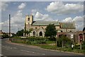
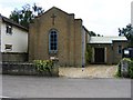
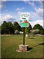
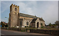
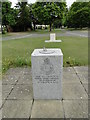
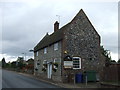
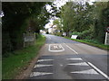
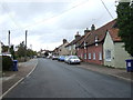
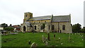
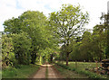
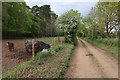
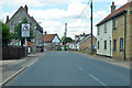
33 photos from this area
Area Information
Key information about the IP28 6SQ including its size, population, and administrative classification.
- Area Type
- Postcode
- Area Size
- 31.0 hectares
- Population
- 1843
- Population Density
- 26 people/km²
House Prices in IP28 6SQ
32
Properties
£196,156
Average Sold Price
£64,000
Lowest Price
£620,000
Highest Price
Showing 32 properties
| Address | Type | Beds | Baths | Last Sale Price | Last Sale Date | |
|---|---|---|---|---|---|---|
| 12 High Street, Tuddenham, IP28 6SQ | Bungalow | - | - | £280,000 | Feb 2019 | |
| Shepperton House, 14 High Street, Tuddenham, IP28 6SQ | Detached | 6 | 4 | £620,000 | Aug 2018 | |
| 11 High Street, Tuddenham, IP28 6SQ | Land | 3 | 1 | £293,500 | Jul 2017 | |
| Wren Cottage, 37 High Street, Tuddenham, IP28 6SQ | Semi-detached | 4 | - | £300,000 | Aug 2016 | |
| 35 High Street, Tuddenham, IP28 6SQ | Terraced | 2 | 1 | £146,500 | May 2016 | |
| 17 High Street, Tuddenham, IP28 6SQ | house | 2 | - | £160,000 | Jul 2015 | |
| 27 High Street, Tuddenham, IP28 6SQ | house | 3 | - | £160,000 | Jul 2014 | |
| 23 High Street, Tuddenham, IP28 6SQ | house | 2 | - | £115,000 | May 2012 | |
| 1 High Street, Tuddenham, IP28 6SQ | Semi-detached | - | - | £125,000 | Feb 2007 | |
| Mulberry Cottage, 15 High Street, Tuddenham, IP28 6SQ | Semi-detached | 3 | 1 | £178,500 | Oct 2003 |
Page 1 of 4
Energy Efficiency in IP28 6SQ
Amenities
Schools
| Rank | School | Type | Entry gender | Ages |
|---|
Explore more schools in this area
Go to Schools tabDemographics
Household Size
Two person
most common
Accommodation Type
Houses
most common
Tenure
63
majority
Ethnic Group
White
most common
Religion
N/A
most common
Household Composition
N/A
most common
Age
47
median
Adults (30-64 years)
most common
Household Deprivation
N/A
with no deprivation
NS-SEC
39
in Lower managerial occupations
Explore more demographic insights in this area
Go to Demographics tabPlanning
Planning Constraints
- Flood RiskPremium
- Ramsar Wetland SitesPremium
- Area of Outstanding Natural BeautyPremium
- Protected Nature ReservePremium
- Protected WoodlandPremium