Area Overview for IP28 6QH
Photos of IP28 6QH
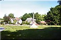
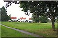
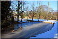
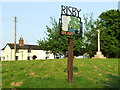
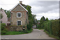
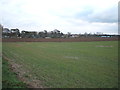
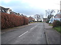
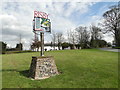
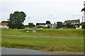
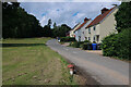
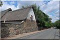
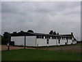
33 photos from this area
Area Information
Key information about the IP28 6QH including its size, population, and administrative classification.
- Area Type
- Postcode
- Area Size
- 5.8 hectares
- Population
- 1233
- Population Density
- 66 people/km²
House Prices in IP28 6QH
25
Properties
£269,175
Average Sold Price
£30,750
Lowest Price
£580,000
Highest Price
Showing 25 properties
| Address | Type | Beds | Baths | Last Sale Price | Last Sale Date | |
|---|---|---|---|---|---|---|
| Manor View, The Green, Risby, IP28 6QH | Detached | 3 | 2 | £30,750 | Sep 2023 | |
| Brigholme, The Green, Risby, IP28 6QH | Bungalow | - | - | £355,000 | Feb 2022 | |
| Troodos, The Green, Risby, IP28 6QH | Bungalow | 4 | 2 | £250,000 | Nov 2016 | |
| Culross House, The Green, Risby, IP28 6QH | Detached | 4 | 2 | £580,000 | Nov 2016 | |
| Woven Gables, The Green, Risby, IP28 6QH | Bungalow | - | - | £233,000 | Sep 2014 | |
| Gage Cottage, The Green, Risby, IP28 6QH | house | - | - | £405,000 | Feb 2012 | |
| Fox Cottage, The Green, Risby, IP28 6QH | house | 5 | 3 | £435,000 | Apr 2006 | |
| Legia, The Green, Risby, IP28 6QH | Bungalow | - | - | £195,000 | Dec 2004 | |
| Misbourne, The Green, Risby, IP28 6QH | Bungalow | 3 | 1 | £144,000 | Feb 2003 | |
| Kilrush, The Green, Risby, IP28 6QH | Detached | 5 | 4 | £64,000 | Feb 1995 |
Page 1 of 3
Energy Efficiency in IP28 6QH
Amenities
Schools
| Rank | School | Type | Entry gender | Ages |
|---|
Explore more schools in this area
Go to Schools tabDemographics
Household Size
Two person
most common
Accommodation Type
Houses
most common
Tenure
71
majority
Ethnic Group
White
most common
Religion
N/A
most common
Household Composition
N/A
most common
Age
47
median
Adults (30-64 years)
most common
Household Deprivation
N/A
with no deprivation
NS-SEC
39
in Lower managerial occupations
Explore more demographic insights in this area
Go to Demographics tabPlanning
Planning Constraints
- Flood RiskPremium
- Ramsar Wetland SitesPremium
- Area of Outstanding Natural BeautyPremium
- Protected Nature ReservePremium
- Protected WoodlandPremium