Area Overview for IP28 6NP
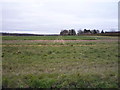
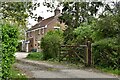
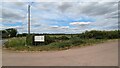
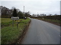
Photos of IP28 6NP

Area Information
IP28 6NP is a small, residential postcode area in England, covering 5.9 hectares and home to 2,592 residents. With a population density of 83 people per square kilometre, it is a compact community where daily life unfolds in a quiet, suburban setting. The area’s modest size and low population density suggest a close-knit environment, where neighbours are likely to know one another. Most residents are adults aged 30–64, reflecting a mature demographic with a strong presence of homeowners. The area’s proximity to rail stations and retail hubs, such as Tesco Red and Asda Bury, ensures practical access to essentials. While it lacks large-scale amenities, its simplicity and accessibility make it appealing for those prioritising convenience over urban vibrancy. The absence of environmental constraints like protected woodlands or Areas of Outstanding Natural Beauty means development is unlikely to be restricted, offering potential for stability in the local housing market. For buyers seeking a peaceful, low-maintenance lifestyle with easy access to nearby services, IP28 6NP presents a straightforward option.
- Area Type
- Postcode
- Area Size
- 5.9 hectares
- Population
- 2592
- Population Density
- 83 people/km²
IP28 6NP is primarily an owner-occupied area, with 72% of homes owned by their residents rather than rented. The accommodation type is predominantly houses, which suggests a traditional, family-oriented housing stock. This contrasts with areas where flats or apartments dominate, and may appeal to buyers seeking more space or a sense of permanence. The small area size—just 5.9 hectares—means the housing stock is limited, potentially leading to a competitive market for available properties. Given the high home ownership rate, rental options are likely scarce, making this area more suitable for buyers than renters. The absence of environmental constraints or planning restrictions (such as protected woodlands or AONBs) may also make it easier to purchase or develop property. However, the small size of the area means buyers should consider proximity to nearby amenities, such as schools and rail stations, when evaluating properties.
House Prices in IP28 6NP
No properties found in this postcode.
Energy Efficiency in IP28 6NP
Residents of IP28 6NP have access to a range of nearby amenities that support everyday living. The area’s proximity to retail hubs like Tesco Red, Asda Bury, and Aldi Bury ensures easy access to groceries and household essentials, reducing the need for long journeys. Rail stations such as Kennett, Bury St Edmunds, and Entrance provide connectivity to larger towns and cities, facilitating commuting or weekend trips. While the data does not mention parks or leisure facilities, the absence of environmental restrictions suggests open spaces may be available for recreation. The compact nature of the area means amenities are within practical reach, contributing to a convenient lifestyle. For those valuing simplicity and accessibility over extensive leisure options, IP28 6NP offers a straightforward, functional environment with minimal hassle.
Amenities
Schools
The nearest school to IP28 6NP is Barrow Church of England Voluntary Controlled Primary School, which holds an Ofsted rating of outstanding. This indicates a high standard of education, which is a significant draw for families with young children. As a primary school, it serves the immediate community, offering a foundation for local education. The absence of secondary schools in the data suggests that families may need to look further afield for secondary education, though the proximity to rail stations like Bury St Edmunds and Kennett could facilitate commuting to larger towns. The presence of a top-rated primary school enhances the area’s appeal, particularly for those prioritising quality education for their children. However, buyers should verify the availability of secondary schooling options and consider how they align with their long-term needs.
| Rank | School | Type | Entry gender | Ages |
|---|
Explore more schools in this area
Go to Schools tabDemographics
The population of IP28 6NP is predominantly adults aged 30–64, with a median age of 47. This suggests a community rooted in middle-aged residents, many of whom may be established professionals or families. Home ownership is high at 72%, indicating a strong presence of owner-occupied properties, which aligns with the area’s focus on houses rather than flats. The predominant ethnic group is White, reflecting a homogenous demographic profile. With a population density of 83 people per square kilometre, the area avoids overcrowding, contributing to a relaxed living environment. The low proportion of younger or older residents may mean fewer childcare demands or retirement-focused services, though this is balanced by the stability of the existing community. The data does not indicate significant deprivation, suggesting that residents generally have access to basic services and infrastructure. This combination of mature demographics, high home ownership, and a lack of density creates a predictable, low-stress neighbourhood.
Household Size
Accommodation Type
Tenure
Ethnic Group
Religion
Household Composition
Age
Household Deprivation
NS-SEC
Explore more demographic insights in this area
Go to Demographics tabPlanning
Planning Constraints
- Flood RiskPremium
- Ramsar Wetland SitesPremium
- Area of Outstanding Natural BeautyPremium
- Protected Nature ReservePremium
- Protected WoodlandPremium