Area Overview for IP28 6HL
Photos of IP28 6HL
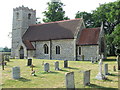
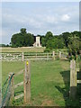
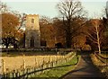
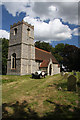
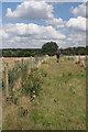
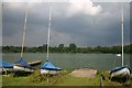
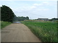
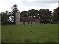
36 photos from this area
Area Information
Key information about the IP28 6HL including its size, population, and administrative classification.
- Area Type
- Postcode
- Area Size
- 17.8 hectares
- Population
- 1492
- Population Density
- 32 people/km²
House Prices in IP28 6HL
7
Properties
£366,900
Average Sold Price
£175,000
Lowest Price
£617,000
Highest Price
Showing 7 properties
| Address | Type | Beds | Baths | Last Sale Price | Last Sale Date | |
|---|---|---|---|---|---|---|
| Drovers Barn, Bury Road, Lackford, IP28 6HL | Detached | 5 | - | £617,000 | Dec 2020 | |
| Brook Lodge, Bury Road, Lackford, IP28 6HL | Detached | - | - | £280,000 | May 2004 | |
| The Old Stables, Bury Road, Lackford, IP28 6HL | Bungalow | 4 | 2 | £332,500 | Sep 2002 | |
| Brook Farm Barns, Bury Road, Lackford, IP28 6HL | Detached | - | - | £430,000 | Aug 2001 | |
| Hedgells Barn, Bury Road, Lackford, IP28 6HL | Semi-detached | 6 | - | £175,000 | Aug 1998 | |
| Brook Farm, Bury Road, Lackford, IP28 6HL | Detached | 6 | - | - | - | |
| Arc Ltd, Sand And Gravel Extraction Site, Road From A 1101 To 6213, Icklingham, IP28 6HL | Industrial | - | - | - | - |
Energy Efficiency in IP28 6HL
Amenities
Schools
| Rank | School | Type | Entry gender | Ages |
|---|
Explore more schools in this area
Go to Schools tabDemographics
Household Size
Two person
most common
Accommodation Type
Houses
most common
Tenure
81
majority
Ethnic Group
White
most common
Religion
N/A
most common
Household Composition
N/A
most common
Age
47
median
Adults (30-64 years)
most common
Household Deprivation
N/A
with no deprivation
NS-SEC
42
in Lower managerial occupations
Explore more demographic insights in this area
Go to Demographics tabPlanning
Planning Constraints
- Flood RiskPremium
- Ramsar Wetland SitesPremium
- Area of Outstanding Natural BeautyPremium
- Protected Nature ReservePremium
- Protected WoodlandPremium