Area Overview for IP28 6DA
Photos of IP28 6DA
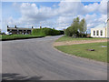
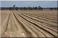
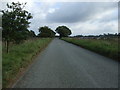
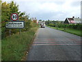
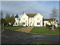
10 photos from this area
Area Information
Key information about the IP28 6DA including its size, population, and administrative classification.
- Area Type
- Postcode
- Area Size
- 1.5 km²
- Population
- 1843
- Population Density
- 26 people/km²
House Prices in IP28 6DA
59
Properties
£348,333
Average Sold Price
£142,750
Lowest Price
£1,100,000
Highest Price
Showing 59 properties
| Address | Type | Beds | Baths | Last Sale Price | Last Sale Date | |
|---|---|---|---|---|---|---|
| Waratah House, 22 The Street, Cavenham, IP28 6DA | house | 5 | 4 | £1,100,000 | Aug 2023 | |
| Felday Cottage, 11 The Street, Cavenham, IP28 6DA | Terraced | 2 | 1 | £325,000 | May 2023 | |
| 10 The Street, Cavenham, IP28 6DA | Terraced | 2 | 1 | £280,000 | May 2023 | |
| 14 The Street, Cavenham, IP28 6DA | house | 2 | 1 | £315,000 | Jul 2022 | |
| 3A The Street, Cavenham, IP28 6DA | house | - | - | £465,000 | Nov 2021 | |
| The Old Post Office, 1 The Street, Cavenham, IP28 6DA | house | 4 | 2 | £635,000 | Jun 2021 | |
| The Old School House, 18 The Street, Cavenham, IP28 6DA | Detached | 3 | 2 | £490,000 | Dec 2020 | |
| 34 The Street, Cavenham, IP28 6DA | Semi-detached | 3 | 1 | £340,000 | Aug 2019 | |
| 16 The Street, Cavenham, IP28 6DA | house | - | - | £250,000 | Jul 2019 | |
| The Pightle, The Street, Cavenham, IP28 6DA | Detached | 5 | 2 | £500,000 | Mar 2015 |
Page 1 of 6
Energy Efficiency in IP28 6DA
Amenities
Schools
| Rank | School | Type | Entry gender | Ages |
|---|
Explore more schools in this area
Go to Schools tabDemographics
Household Size
Two person
most common
Accommodation Type
Houses
most common
Tenure
63
majority
Ethnic Group
White
most common
Religion
N/A
most common
Household Composition
N/A
most common
Age
47
median
Adults (30-64 years)
most common
Household Deprivation
N/A
with no deprivation
NS-SEC
39
in Lower managerial occupations
Explore more demographic insights in this area
Go to Demographics tabPlanning
Planning Constraints
- Flood RiskPremium
- Ramsar Wetland SitesPremium
- Area of Outstanding Natural BeautyPremium
- Protected Nature ReservePremium
- Protected WoodlandPremium