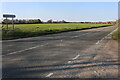
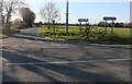
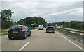
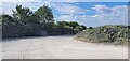
Area Overview for IP28 6BF
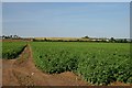
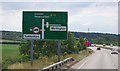
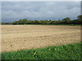
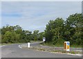
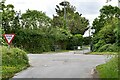
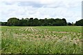
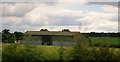
Photos of IP28 6BF

Area Information
IP28 6BF is a small, compact postcode area in England covering 53 hectares, home to 2334 residents. Its low population density of 98 people per square kilometre suggests a quiet, residential character, with homes predominantly in private ownership. The area’s proximity to Kennett Railway Station and RAF Mildenhall offers practical connectivity, while nearby towns like Mildenhall provide retail and services. Daily life here is likely shaped by the local community’s demographics: a median age of 47, with most residents aged between 30 and 64. This suggests a stable, established population, possibly with families and professionals. The area’s lack of environmental constraints, such as protected woodlands or AONB designations, means development is not restricted, though the small size of the postcode implies limited housing stock. For buyers, this means a focused search within the area or its immediate surroundings, with homes likely centered around traditional housing types. The balance of safety, connectivity, and proximity to amenities makes it a practical choice for those prioritising convenience over urban vibrancy.
- Area Type
- Postcode
- Area Size
- 53.0 hectares
- Population
- 2334
- Population Density
- 98 people/km²
IP28 6BF is a predominantly owner-occupied area, with 73% of homes in private hands. The accommodation type is largely houses, which is typical for smaller, residential postcodes with limited development. This suggests a market focused on individual ownership rather than rental properties, possibly reflecting the area’s appeal to families or professionals seeking stability. The small size of the postcode—just 53 hectares—means the housing stock is likely limited, with buyers needing to consider nearby areas for more options. The presence of Kennett Railway Station and proximity to Mildenhall may influence property values, offering access to commuting routes and retail hubs. For buyers, this area is best suited to those prioritising a quiet, low-density environment over high-rise or urban living. The lack of planning constraints, such as protected nature reserves, may also make it more flexible for future development or renovation.
House Prices in IP28 6BF
Showing 2 properties
| Address | Type | Beds | Baths | Last Sale Price | Last Sale Date | |
|---|---|---|---|---|---|---|
| Needham Chalks Ltd, Chalk Quarry, Access Road From C 623 To Chalk Quarry, Barton Mills, IP28 6BF | Industrial | - | - | - | - | |
| Landfill Site, Access Road From C 623 To Chalk Quarry, Barton Mills, IP28 6BF | commercial | - | - | - | - |
Energy Efficiency in IP28 6BF
Living in IP28 6BF offers access to nearby amenities, including retail options in Mildenhall such as Waitrose Little Waitrose, Sainsburys, and Heron. These shops provide convenience for grocery and daily needs, though the area itself appears to lack standalone retail hubs. The presence of RAF Mildenhall adds a unique character to the local landscape, though its influence on civilian leisure or dining is not specified. Kennett Railway Station connects residents to broader networks, enabling travel to nearby towns. While the area’s small size means it lacks large-scale leisure facilities, the surrounding region likely offers more options. The combination of practical retail access and quiet surroundings creates a lifestyle suited to those prioritising convenience and a low-key environment over bustling urban amenities.
Amenities
Schools
| Rank | School | Type | Entry gender | Ages |
|---|
Explore more schools in this area
Go to Schools tabDemographics
The population of IP28 6BF skews towards adults aged 30–64, with a median age of 47. This indicates a mature, stable community, likely with a mix of families and professionals. Home ownership is high at 73%, suggesting long-term residency and a preference for private property over rentals. The area’s accommodation is predominantly houses, which aligns with the demographic profile of older, settled residents. The predominant ethnic group is White, with no specific data on other groups provided. The low population density of 98 people per square kilometre reinforces the area’s rural or semi-rural nature, offering space and privacy. While no deprivation data is explicitly stated, the combination of high home ownership and a mature age profile may suggest a community with established economic stability. However, the absence of detailed diversity metrics means the full range of social dynamics remains unexplored.
Household Size
Accommodation Type
Tenure
Ethnic Group
Religion
Household Composition
Age
Household Deprivation
NS-SEC
Explore more demographic insights in this area
Go to Demographics tabPlanning
Planning Constraints
- Flood RiskPremium
- Ramsar Wetland SitesPremium
- Area of Outstanding Natural BeautyPremium
- Protected Nature ReservePremium
- Protected WoodlandPremium