Area Overview for IP27 9AU
Photos of IP27 9AU
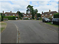
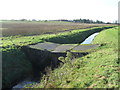
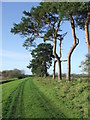
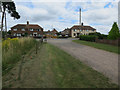
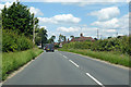
11 photos from this area
Area Information
Key information about the IP27 9AU including its size, population, and administrative classification.
- Area Type
- Postcode
- Area Size
- 52.6 hectares
- Population
- 1608
- Population Density
- 37 people/km²
House Prices in IP27 9AU
73
Properties
£169,207
Average Sold Price
£54,500
Lowest Price
£290,000
Highest Price
Showing 73 properties
| Address | Type | Beds | Baths | Last Sale Price | Last Sale Date | |
|---|---|---|---|---|---|---|
| 43 Caudle Avenue, Lakenheath, IP27 9AU | Bungalow | 3 | 1 | £223,000 | Oct 2025 | |
| 3 Caudle Avenue, Lakenheath, IP27 9AU | Bungalow | 3 | 1 | £215,000 | May 2025 | |
| 1 Caudle Avenue, Lakenheath, IP27 9AU | Detached | 3 | 1 | £247,000 | Oct 2024 | |
| 28 Caudle Avenue, Lakenheath, IP27 9AU | Bungalow | 2 | 1 | £250,000 | Jul 2024 | |
| 65 Caudle Avenue, Lakenheath, IP27 9AU | Bungalow | 3 | 1 | £245,000 | Jun 2024 | |
| 21 Caudle Avenue, Lakenheath, IP27 9AU | Bungalow | 2 | 1 | £220,000 | Mar 2024 | |
| 51 Caudle Avenue, Lakenheath, IP27 9AU | Bungalow | 2 | 1 | £167,500 | Feb 2024 | |
| 48 Caudle Avenue, Lakenheath, IP27 9AU | Detached | 3 | 2 | £202,000 | Jul 2023 | |
| 9 Caudle Avenue, Lakenheath, IP27 9AU | Bungalow | 3 | 1 | £250,000 | May 2023 | |
| 8 Caudle Avenue, Lakenheath, IP27 9AU | Bungalow | 3 | 1 | £255,000 | Feb 2023 |
Page 1 of 8
Energy Efficiency in IP27 9AU
Amenities
Schools
| Rank | School | Type | Entry gender | Ages |
|---|
Explore more schools in this area
Go to Schools tabDemographics
Household Size
One person
most common
Accommodation Type
Houses
most common
Tenure
52
majority
Ethnic Group
White
most common
Religion
N/A
most common
Household Composition
N/A
most common
Age
47
median
Adults (30-64 years)
most common
Household Deprivation
N/A
with no deprivation
NS-SEC
24
in Lower managerial occupations
Explore more demographic insights in this area
Go to Demographics tabPlanning
Planning Constraints
- Flood RiskPremium
- Ramsar Wetland SitesPremium
- Area of Outstanding Natural BeautyPremium
- Protected Nature ReservePremium
- Protected WoodlandPremium