Area Overview for IP27 0YQ
Photos of IP27 0YQ
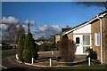
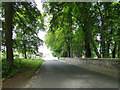
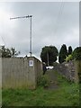
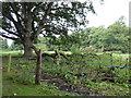
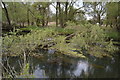
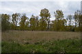
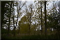
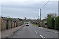
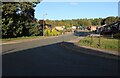
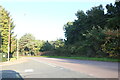
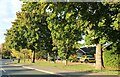
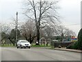
31 photos from this area
Area Information
Key information about the IP27 0YQ including its size, population, and administrative classification.
- Area Type
- Postcode
- Area Size
- 1.7 hectares
- Population
- 1664
- Population Density
- 2240 people/km²
House Prices in IP27 0YQ
24
Properties
£156,329
Average Sold Price
£50,000
Lowest Price
£235,000
Highest Price
Showing 24 properties
| Address | Type | Beds | Baths | Last Sale Price | Last Sale Date | |
|---|---|---|---|---|---|---|
| 29 Blackbird Avenue, Brandon, IP27 0YQ | Bungalow | - | - | £235,000 | Aug 2023 | |
| 21 Blackbird Avenue, Brandon, IP27 0YQ | Bungalow | 2 | 1 | £230,000 | May 2023 | |
| 36 Blackbird Avenue, Brandon, IP27 0YQ | Bungalow | 2 | 1 | £220,000 | Feb 2022 | |
| 39 Blackbird Avenue, Brandon, IP27 0YQ | Bungalow | - | - | £230,000 | Feb 2022 | |
| 28 Blackbird Avenue, Brandon, IP27 0YQ | Bungalow | 2 | - | £200,000 | Dec 2020 | |
| 27 Blackbird Avenue, Brandon, IP27 0YQ | Bungalow | 2 | 1 | £180,000 | Jul 2020 | |
| 16 Blackbird Avenue, Brandon, IP27 0YQ | Bungalow | - | - | £179,500 | Nov 2018 | |
| 37 Blackbird Avenue, Brandon, IP27 0YQ | Bungalow | 2 | - | £190,000 | May 2017 | |
| 24 Blackbird Avenue, Brandon, IP27 0YQ | Bungalow | 2 | - | £180,000 | Feb 2017 | |
| 20 Blackbird Avenue, Brandon, IP27 0YQ | Bungalow | - | - | £180,000 | Aug 2015 |
Page 1 of 3
Energy Efficiency in IP27 0YQ
Amenities
Schools
| Rank | School | Type | Entry gender | Ages |
|---|
Explore more schools in this area
Go to Schools tabDemographics
Household Size
Two person
most common
Accommodation Type
Houses
most common
Tenure
86
majority
Ethnic Group
White
most common
Religion
N/A
most common
Household Composition
N/A
most common
Age
47
median
Adults (30-64 years)
most common
Household Deprivation
N/A
with no deprivation
NS-SEC
22
in Lower managerial occupations
Explore more demographic insights in this area
Go to Demographics tabPlanning
Planning Constraints
- Flood RiskPremium
- Ramsar Wetland SitesPremium
- Area of Outstanding Natural BeautyPremium
- Protected Nature ReservePremium
- Protected WoodlandPremium