Area Overview for IP27 0TJ
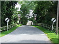
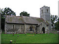
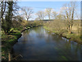
Photos of IP27 0TJ


Area Information
Living in IP27 0TJ means being part of a small, tightly knit residential cluster in eastern England. With a population of 1,853 spread across 44 people per square kilometre, the area feels intimate yet functional. The community is predominantly composed of adults aged 30–64, with a median age of 47, suggesting a stable demographic of homeowners and long-term residents. This postcode is not a sprawling suburb but a focused cluster of homes, likely centred around local amenities and transport links. Daily life here is shaped by proximity to essential services, including multiple retail outlets and rail stations. The area’s small size means residents are close to schools, shops, and transport hubs, offering a balance between convenience and a quieter, less congested environment. While it lacks the vibrancy of a city centre, IP27 0TJ provides a straightforward, practical lifestyle with minimal planning constraints and a low crime risk. For those seeking a place to settle rather than a bustling metropolis, this area offers a grounded, community-focused alternative.
- Area Type
- Postcode
- Area Size
- Not available
- Population
- 1853
- Population Density
- 44 people/km²
The property market in IP27 0TJ is defined by a strong presence of owner-occupied homes, with 58% of residents owning their properties. This suggests a community where long-term investment in housing is common, and the market is likely to be relatively stable. The accommodation type is predominantly houses, which may appeal to those seeking more space or privacy compared to flats. Given the small size of the area, the housing stock is likely limited, making it a niche market for buyers. The high home ownership rate implies that rental properties are less prevalent, potentially reducing competition for buyers. For those considering the area, the focus on houses means that property searches will be concentrated on individual homes rather than larger developments. The small postcode area also means that buyers should look beyond the immediate postcode to surrounding regions for additional options. The market’s character is one of simplicity and practicality, with fewer high-end properties and more emphasis on functional, family-friendly homes.
House Prices in IP27 0TJ
Showing 2 properties
| Address | Type | Beds | Baths | Last Sale Price | Last Sale Date | |
|---|---|---|---|---|---|---|
| Forestry Commission, Road From C 622 To County Boundary, Santon Downham, IP27 0TJ | Office | - | - | - | - | |
| The Nursery, Forestry Commission, Road From C 622 To County Boundary, Santon Downham, IP27 0TJ | Farm | - | - | - | - |
Energy Efficiency in IP27 0TJ
The lifestyle in IP27 0TJ is shaped by its proximity to essential amenities. Retail options include Aldi Brandon, Tesco Brandon, and Budgens Weeting, providing access to groceries and everyday essentials. The rail network, with stations like Brandon and Thetford, offers easy travel to nearby towns, while RAF Lakenheath, though a military base, adds to the area’s strategic location. The absence of major leisure or entertainment venues means the area is more subdued, catering to those who prioritise convenience over nightlife. For residents, the practicality of nearby shops and transport links ensures daily needs are met without long journeys. The small size of the area means that amenities are closely clustered, reducing the need for extensive travel. While it lacks large parks or cultural hubs, the focus on functionality and accessibility makes IP27 0TJ suitable for those seeking a straightforward, low-maintenance lifestyle.
Amenities
Schools
Residents of IP27 0TJ have access to a range of primary schools, including Elveden Church of England Voluntary Aided Primary School and Elveden Church of England Primary Academy, both of which serve the local community. The latter holds an outstanding Ofsted rating, reflecting high standards in education. Nearby, Glade Academy, an academy with a good Ofsted rating, provides secondary education options. The mix of school types ensures families have choices, from faith-based primary schools to state-run academies. The presence of an outstanding primary school is a significant draw for families prioritising educational quality, while the academy offers a broader curriculum for older students. The proximity of these schools to the area means parents can access a comprehensive education system without long commutes. For those considering IP27 0TJ, the availability of well-rated schools is a key factor in assessing the area’s suitability for raising children.
| Rank | School | Type | Entry gender | Ages |
|---|
Explore more schools in this area
Go to Schools tabDemographics
The population of IP27 0TJ is characterised by a median age of 47, with the majority of residents falling within the 30–64 age range. This suggests a mature, established community with a focus on stability rather than rapid growth. Home ownership is high, at 58%, indicating that many residents are long-term residents with a vested interest in the area. The accommodation type is predominantly houses, which aligns with the demographic profile of older, family-oriented households. The predominant ethnic group is White, though specific diversity statistics are not provided. The age distribution and home ownership rates suggest a low turnover of residents, with fewer young families or transient populations. This creates a consistent, low-deprivation environment where services and amenities are tailored to the needs of an older, settled community. The lack of significant demographic shifts means the area maintains a cohesive character, with little pressure on local infrastructure or housing stock.
Household Size
Accommodation Type
Tenure
Ethnic Group
Religion
Household Composition
Age
Household Deprivation
NS-SEC
Explore more demographic insights in this area
Go to Demographics tabPlanning
Planning Constraints
- Flood RiskPremium
- Ramsar Wetland SitesPremium
- Area of Outstanding Natural BeautyPremium
- Protected Nature ReservePremium
- Protected WoodlandPremium