Area Overview for IP27 0PN
Photos of IP27 0PN
Area Information
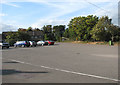
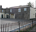
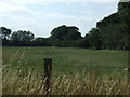
Living in IP27 0PN means being part of a small, low-density residential cluster in rural England. With a population of 1,368 spread across 22 people per square kilometre, this area feels quiet and unspoiled. The community is characterised by a mature demographic, with a median age of 47 and most residents falling between 30 and 64 years old. Home ownership is high at 77%, with houses making up the majority of accommodation. This suggests a stable, long-term population rather than transient renters. The area’s small size means it is likely to feel close-knit, with limited commercial or industrial development. Proximity to nearby towns and amenities is key, as the postcode itself covers only a small cluster of properties. For those seeking a peaceful, family-oriented environment with minimal urban pressure, IP27 0PN offers a quiet alternative, though its remoteness may require reliance on nearby towns for broader services.
- Area Type
- Postcode
- Area Size
- Not available
- Population
- 1368
- Population Density
- 22 people/km²
The property market in IP27 0PN is dominated by owner-occupied homes, with 77% of residents living in properties they own. This high rate of home ownership suggests a community of long-term residents rather than a rental market. The accommodation type is predominantly houses, which is typical for low-density areas and may include detached or semi-detached properties. Given the small population and limited land area, the housing stock is likely to be constrained, making the area appealing to buyers seeking a quiet, stable environment. However, the limited size of the postcode means that property availability is restricted, and buyers may need to consider nearby areas for more options. The presence of schools and transport links nearby could enhance the area’s desirability for families, though the market may be niche due to its rural character and small scale.
House Prices in IP27 0PN
No properties found in this postcode.
Energy Efficiency in IP27 0PN
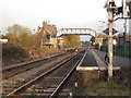
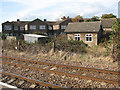
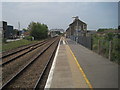
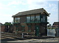
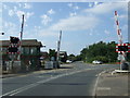
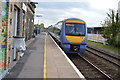
Daily life in IP27 0PN is shaped by its proximity to practical amenities. Residents have access to five retail outlets, including Aldi Brandon, Tesco Brandon, and Budgens Weeting, ensuring everyday shopping needs are met. The five railway stations, such as Brandon Railway Station, provide reliable connections to nearby towns and beyond. The presence of RAF Lakenheath airport nearby offers additional travel options, though its impact on local life is not detailed. The area’s small size means amenities are likely to be clustered, fostering a sense of convenience. While the data does not specify parks or leisure facilities, the low population density suggests space for outdoor activities. Overall, the lifestyle here balances practicality with a quiet, rural backdrop, ideal for those who value accessibility without urban congestion.
Amenities
Schools
Residents of IP27 0PN have access to two primary schools within practical reach: Weeting Voluntary Controlled Primary School and Weeting Church of England Primary School. Both are primary institutions, though only the latter holds an Ofsted rating of ‘good’. This mix provides families with two options for early education, though no secondary schools are listed in the data. The presence of two primary schools may indicate a focus on local education, but parents seeking secondary schooling would need to look beyond the immediate area. The ‘good’ rating at Weeting Church of England Primary School suggests a reliable standard of education, though the lack of additional data on school performance or capacity means further research would be needed to assess suitability for individual families.
| Rank | School | Type | Entry gender | Ages |
|---|
Explore more schools in this area
Go to Schools tabDemographics
The community in IP27 0PN is predominantly composed of adults aged 30 to 64, with a median age of 47. This suggests a mature population, likely with established careers and family structures. Home ownership is strong at 77%, indicating a stable, long-term resident base rather than a transient rental market. The majority of properties are houses, which aligns with the area’s low population density and likely suburban or rural character. The predominant ethnic group is White, though specific data on diversity or deprivation is not provided. The age profile implies a balance between working-age adults and those nearing retirement, which may influence local services and amenities. With no data on deprivation levels, it is reasonable to assume that the area’s safety and low crime risk (score 83/100) contribute to a quality of life that appeals to those seeking stability.
Household Size
Accommodation Type
Tenure
Ethnic Group
Religion
Household Composition
Age
Household Deprivation
NS-SEC
Explore more demographic insights in this area
Go to Demographics tabPlanning
Planning Constraints
- Flood RiskPremium
- Ramsar Wetland SitesPremium
- Area of Outstanding Natural BeautyPremium
- Protected Nature ReservePremium
- Protected WoodlandPremium