Area Overview for IP27 0HN
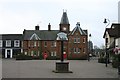
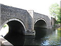
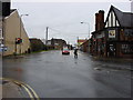
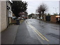
Photos of IP27 0HN


Area Information
IP27 0HN is a small, tightly knit residential postcode in England, home to 2,426 residents. It is a quiet, compact area where daily life is shaped by its modest size and proximity to key amenities. The community here skews towards middle-aged adults, with a median age of 47 and most residents falling within the 30–64 age range. This suggests a stable population, likely with families and long-term residents. The area is predominantly composed of houses, reflecting a traditional, low-density housing stock. While it lacks the density of larger towns, its proximity to Brandon Railway Station and nearby retail hubs like Aldi and Tesco ensures practical connectivity. The presence of RAF Lakenheath nearby adds a unique character, though it remains a civilian-focused postcode. Living here means a balance of residential calm and access to essential services, with the broadband and mobile coverage scores indicating reliable digital connectivity for everyday needs. The area’s small scale means it is not a hub for nightlife or entertainment, but it offers a straightforward, functional lifestyle for those prioritising convenience and safety.
- Area Type
- Postcode
- Area Size
- Not available
- Population
- 2426
- Population Density
- 2844 people/km²
The property market in IP27 0HN is characterised by a low home ownership rate of 44%, indicating that nearly half of residents rent their homes. This suggests a rental market that may cater to both short-term tenants and those seeking long-term housing. The area is predominantly composed of houses, which are more common than flats or apartments, reflecting a traditional, low-density housing stock. Given the small size of the postcode, the housing stock is limited, and buyers may need to look beyond immediate surroundings for more options. The predominance of houses may appeal to families or individuals seeking space, but the lower home ownership rate could signal a reliance on private rentals or shared housing. Prospective buyers should consider the area’s limited scale and the potential need to explore nearby regions for a broader selection of properties.
House Prices in IP27 0HN
No properties found in this postcode.
Energy Efficiency in IP27 0HN
The lifestyle in IP27 0HN is defined by its proximity to essential amenities. Residents have access to five retail outlets, including Aldi Brandon, Tesco Brandon, and Budgens Weeting, ensuring everyday shopping needs are met locally. The area’s rail network, with stations like Brandon Railway Station, offers reliable links to nearby towns and cities. For those interested in travel, RAF Lakenheath is a notable nearby feature, though its impact on civilian life is minimal. The absence of major parks or leisure facilities means outdoor recreation may require venturing further afield. The compact nature of the area fosters a sense of convenience, with amenities clustered closely together. While it lacks the vibrancy of larger towns, the practicality of its retail and transport options makes it suitable for those prioritising efficiency over expansive leisure opportunities.
Amenities
Schools
Residents of IP27 0HN have access to three schools within practical reach. Forest Community Primary School and Glade Primary School serve younger children, offering foundational education. For older students, Forest Academy is an academy with an Ofsted rating of 'good', indicating a higher standard of teaching and facilities. The mix of primary and academy schools provides a range of educational options, though the absence of secondary schools in the area may require commuting. Families with children will need to consider the proximity of these institutions to their homes, as well as the quality of education they offer. The 'good' rating at Forest Academy suggests a reliable secondary education option, but the lack of further school data means it is unclear whether the area’s schools collectively meet the needs of all age groups.
| Rank | School | Type | Entry gender | Ages |
|---|
Explore more schools in this area
Go to Schools tabDemographics
The population of IP27 0HN is 2,426, with a median age of 47. Most residents are adults aged 30–64, indicating a mature, established community. Home ownership here is relatively low at 44%, suggesting a mix of owner-occupied properties and rental stock. The area is predominantly composed of houses, which aligns with its small, residential character. The predominant ethnic group is White, though no further breakdown of diversity is provided. This demographic profile suggests a community focused on stability, with fewer young families compared to areas with higher birth rates. The absence of data on deprivation levels means it is unclear how economic factors influence quality of life, but the moderate age range and housing type imply a balance between older residents and working-age adults. The lack of significant population growth or youth presence may affect local services and amenities, though the area’s size limits the scope for large-scale development.
Household Size
Accommodation Type
Tenure
Ethnic Group
Religion
Household Composition
Age
Household Deprivation
NS-SEC
Explore more demographic insights in this area
Go to Demographics tabPlanning
Planning Constraints
- Flood RiskPremium
- Ramsar Wetland SitesPremium
- Area of Outstanding Natural BeautyPremium
- Protected Nature ReservePremium
- Protected WoodlandPremium