Area Overview for IP26 5DT
Photos of IP26 5DT
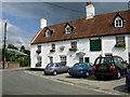
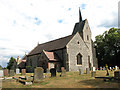
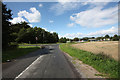
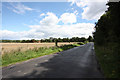
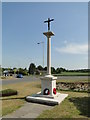


67 photos from this area
Area Information
Key information about the IP26 5DT including its size, population, and administrative classification.
- Area Type
- Postcode
- Area Size
- 2.1 hectares
- Population
- 2133
- Population Density
- 22 people/km²
House Prices in IP26 5DT
45
Properties
£162,080
Average Sold Price
£53,500
Lowest Price
£275,000
Highest Price
Showing 45 properties
| Address | Type | Beds | Baths | Last Sale Price | Last Sale Date | |
|---|---|---|---|---|---|---|
| 14 The Lammas, Mundford, IP26 5DT | Detached | 2 | 1 | £200,000 | Dec 2024 | |
| 54 The Lammas, Mundford, IP26 5DT | Bungalow | 3 | 2 | £250,000 | Nov 2024 | |
| 46 The Lammas, Mundford, IP26 5DT | Bungalow | 2 | 1 | £265,000 | Dec 2022 | |
| 82 The Lammas, Mundford, IP26 5DT | Bungalow | - | - | £275,000 | Apr 2022 | |
| 20 The Lammas, Mundford, IP26 5DT | Retail | 2 | 1 | £222,500 | Mar 2022 | |
| 22 The Lammas, Mundford, IP26 5DT | house | 3 | - | £265,000 | Feb 2022 | |
| 78 The Lammas, Mundford, IP26 5DT | Bungalow | 3 | 2 | £275,000 | Feb 2021 | |
| 62 The Lammas, Mundford, IP26 5DT | Bungalow | - | - | £208,000 | Mar 2020 | |
| 88 The Lammas, Mundford, IP26 5DT | Bungalow | 3 | 1 | £222,500 | Feb 2020 | |
| 6 The Lammas, Mundford, IP26 5DT | house | 3 | - | £230,000 | Mar 2018 |
Page 1 of 5
Energy Efficiency in IP26 5DT
Amenities
Schools
| Rank | School | Type | Entry gender | Ages |
|---|
Explore more schools in this area
Go to Schools tabDemographics
Household Size
Two person
most common
Accommodation Type
Houses
most common
Tenure
75
majority
Ethnic Group
White
most common
Religion
N/A
most common
Household Composition
N/A
most common
Age
47
median
Adults (30-64 years)
most common
Household Deprivation
N/A
with no deprivation
NS-SEC
30
in Lower managerial occupations
Explore more demographic insights in this area
Go to Demographics tabPlanning
Planning Constraints
- Flood RiskPremium
- Ramsar Wetland SitesPremium
- Area of Outstanding Natural BeautyPremium
- Protected Nature ReservePremium
- Protected WoodlandPremium