Area Overview for IP26 4QP
Photos of IP26 4QP
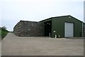
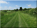
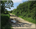
3 photos from this area
Area Information
Key information about the IP26 4QP including its size, population, and administrative classification.
- Area Type
- Postcode
- Area Size
- 52.1 hectares
- Population
- 1268
- Population Density
- 18 people/km²
House Prices in IP26 4QP
35
Properties
£218,545
Average Sold Price
£59,500
Lowest Price
£430,000
Highest Price
Showing 35 properties
| Address | Type | Beds | Baths | Last Sale Price | Last Sale Date | |
|---|---|---|---|---|---|---|
| 35 Whiteplot Road, Methwold Hythe, IP26 4QP | Bungalow | - | - | £301,500 | Jun 2022 | |
| 49 Whiteplot Road, Methwold Hythe, IP26 4QP | Bungalow | - | - | £430,000 | Apr 2020 | |
| 5 Whiteplot Road, Methwold Hythe, IP26 4QP | Semi-detached | 4 | - | £182,000 | Jun 2019 | |
| 10 Whiteplot Road, Methwold Hythe, IP26 4QP | Detached | 4 | 1 | £315,000 | Jun 2019 | |
| 12 Whiteplot Road, Methwold Hythe, IP26 4QP | Detached | 4 | 2 | £320,000 | Dec 2016 | |
| 20 Whiteplot Road, Methwold Hythe, IP26 4QP | Terraced | 2 | 1 | £145,000 | Jan 2016 | |
| 37A Whiteplot Road, Methwold Hythe, IP26 4QP | Detached | 4 | 3 | £239,950 | Nov 2015 | |
| 41 Whiteplot Road, Methwold Hythe, IP26 4QP | Bungalow | 2 | - | £105,500 | Feb 2014 | |
| 43 Whiteplot Road, Methwold Hythe, IP26 4QP | Semi-detached | 2 | - | £87,000 | Dec 2013 | |
| 45 Whiteplot Road, Methwold Hythe, IP26 4QP | house | - | - | £59,500 | Dec 2000 |
Page 1 of 4
Energy Efficiency in IP26 4QP
Amenities
Schools
| Rank | School | Type | Entry gender | Ages |
|---|
Explore more schools in this area
Go to Schools tabDemographics
Household Size
Family (3-5 people)
most common
Accommodation Type
Houses
most common
Tenure
46
majority
Ethnic Group
White
most common
Religion
N/A
most common
Household Composition
N/A
most common
Age
47
median
Adults (30-64 years)
most common
Household Deprivation
N/A
with no deprivation
NS-SEC
29
in Lower managerial occupations
Explore more demographic insights in this area
Go to Demographics tabPlanning
Planning Constraints
- Flood RiskPremium
- Ramsar Wetland SitesPremium
- Area of Outstanding Natural BeautyPremium
- Protected Nature ReservePremium
- Protected WoodlandPremium