Area Overview for IP26 4PH
Photos of IP26 4PH

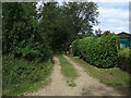
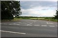
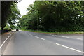
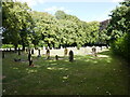
14 photos from this area
Area Information
Key information about the IP26 4PH including its size, population, and administrative classification.
- Area Type
- Postcode
- Area Size
- 16.9 hectares
- Population
- 2582
- Population Density
- 70 people/km²
House Prices in IP26 4PH
23
Properties
£213,333
Average Sold Price
£90,000
Lowest Price
£425,000
Highest Price
Showing 23 properties
| Address | Type | Beds | Baths | Last Sale Price | Last Sale Date | |
|---|---|---|---|---|---|---|
| 3 Thornham Road, Methwold, IP26 4PH | Detached | 4 | 2 | £180,000 | Mar 2025 | |
| 9 Thornham Road, Methwold, IP26 4PH | Bungalow | 4 | 1 | £425,000 | Feb 2025 | |
| 16 Thornham Road, Methwold, IP26 4PH | Semi-detached | 3 | 2 | £183,000 | Jul 2020 | |
| 12 Thornham Road, Methwold, IP26 4PH | Detached | 4 | 1 | £250,000 | Sep 2017 | |
| 1 Thornham Road, Methwold, IP26 4PH | house | - | - | £213,000 | Sep 2015 | |
| Thornham Lodge, 19A Thornham Road, Methwold, IP26 4PH | Detached | 3 | - | £285,000 | Jan 2014 | |
| Holly Cottage, 19 Thornham Road, Methwold, IP26 4PH | Detached | - | - | £190,000 | Nov 2005 | |
| 18 Thornham Road, Methwold, IP26 4PH | Semi-detached | 3 | - | £104,000 | Jul 2003 | |
| 11 Thornham Road, Methwold, IP26 4PH | house | - | - | £90,000 | Aug 2000 | |
| 17 Thornham Road, Methwold, IP26 4PH | Detached | 6 | 1 | - | - |
Page 1 of 3
Energy Efficiency in IP26 4PH
Amenities
Schools
| Rank | School | Type | Entry gender | Ages |
|---|
Explore more schools in this area
Go to Schools tabDemographics
Household Size
Two person
most common
Accommodation Type
Houses
most common
Tenure
73
majority
Ethnic Group
White
most common
Religion
N/A
most common
Household Composition
N/A
most common
Age
47
median
Adults (30-64 years)
most common
Household Deprivation
N/A
with no deprivation
NS-SEC
29
in Lower managerial occupations
Explore more demographic insights in this area
Go to Demographics tabPlanning
Planning Constraints
- Flood RiskPremium
- Ramsar Wetland SitesPremium
- Area of Outstanding Natural BeautyPremium
- Protected Nature ReservePremium
- Protected WoodlandPremium