Area Overview for IP25 7SZ
Photos of IP25 7SZ
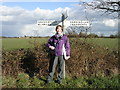
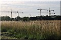
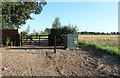
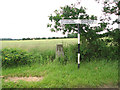
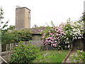
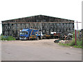
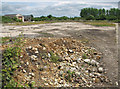
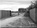
14 photos from this area
Area Information
Key information about the IP25 7SZ including its size, population, and administrative classification.
- Area Type
- Postcode
- Area Size
- 17.6 hectares
- Population
- 1216
- Population Density
- 36 people/km²
House Prices in IP25 7SZ
11
Properties
£307,500
Average Sold Price
£290,000
Lowest Price
£325,000
Highest Price
Showing 11 properties
| Address | Type | Beds | Baths | Last Sale Price | Last Sale Date | |
|---|---|---|---|---|---|---|
| Larch Tree Bungalow, Hook Lane, Cranworth, IP25 7SZ | Bungalow | - | - | £325,000 | Nov 2022 | |
| Homestead, Hook Lane, Cranworth, IP25 7SZ | Bungalow | - | - | £290,000 | Dec 2021 | |
| Hill Crest Bungalow, Hook Lane, Cranworth, IP25 7SZ | Bungalow | 3 | 1 | - | - | |
| Temporary Caravan At Homestead, Hook Lane, Cranworth, IP25 7SZ | Mobile Home | - | - | - | - | |
| Quaters Annexe, Hook Lane, Cranworth, IP25 7SZ | Terraced | - | - | - | - | |
| Quarters, Hook Lane, Cranworth, IP25 7SZ | Bungalow | 1 | 1 | - | - | |
| Pincents Drift Barn, Hook Lane, Cranworth, IP25 7SZ | Detached | - | - | - | - | |
| General Johnsons, Hook Lane, Cranworth, IP25 7SZ | Bungalow | - | - | - | - | |
| Annexe At Hill Crest Bungalow, Hook Lane, Cranworth, IP25 7SZ | Semi-detached | - | - | - | - | |
| The Old Canteen, Hook Lane, Cranworth, IP25 7SZ | Detached | - | - | - | - |
Page 1 of 2
Energy Efficiency in IP25 7SZ
Amenities
Schools
| Rank | School | Type | Entry gender | Ages |
|---|
Explore more schools in this area
Go to Schools tabDemographics
Household Size
Two person
most common
Accommodation Type
Houses
most common
Tenure
81
majority
Ethnic Group
White
most common
Religion
N/A
most common
Household Composition
N/A
most common
Age
47
median
Adults (30-64 years)
most common
Household Deprivation
N/A
with no deprivation
NS-SEC
36
in Lower managerial occupations
Explore more demographic insights in this area
Go to Demographics tabPlanning
Planning Constraints
- Flood RiskPremium
- Ramsar Wetland SitesPremium
- Area of Outstanding Natural BeautyPremium
- Protected Nature ReservePremium
- Protected WoodlandPremium