Area Overview for IP25 7SP
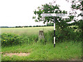
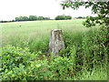
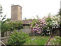
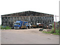
Photos of IP25 7SP


Area Information
Living in IP25 7SP means being part of a small, tightly knit residential cluster in eastern England. With a population of just 1,216 people spread across 36 individuals per square kilometre, this area feels quiet and unassuming. The low density suggests a focus on private homes rather than high-rise living, and the community is largely composed of adults aged 30–64, reflecting a mature demographic. Daily life here is likely characterised by a slower pace, with residents prioritising stability and long-term residency. The area’s small size means local amenities are within practical reach, though it remains a commuter hub for nearby towns. IP25 7SP is not a place for those seeking urban vibrancy—it is a rural or semi-rural postcode where the primary concerns are home ownership, family life, and proximity to essential services. Its modest population and low crime risk make it an attractive option for buyers seeking a peaceful, low-maintenance environment.
- Area Type
- Postcode
- Area Size
- Not available
- Population
- 1216
- Population Density
- 36 people/km²
The property market in IP25 7SP is dominated by owner-occupied homes, with 81% of residents living in properties they own. This high rate of home ownership suggests a community that values long-term residency and stability. The accommodation types are primarily houses, which is typical for rural or semi-rural areas where larger properties are more common than flats. Given the small population and low density, the housing stock is likely limited to a few hundred homes, making the area a niche market for buyers seeking a quiet, low-traffic environment. The focus on houses rather than rental properties indicates that this is not a high-demand area for investors or tenants. For prospective buyers, this means a limited selection of properties, but also a lower risk of competition. The small size of the area means that any new developments would have minimal impact on the local character.
House Prices in IP25 7SP
No properties found in this postcode.
Energy Efficiency in IP25 7SP
The lifestyle in IP25 7SP is shaped by its proximity to practical amenities. Within reach are five retail outlets, including East of England Co-operative Co, Aldi Toftwood, and Lidl Toftwood, providing everyday shopping options. The nearest metro station is in Dereham, which connects residents to larger towns for more extensive services. While the area lacks parks or leisure facilities, the low population density suggests open spaces may be available nearby. The retail options indicate a focus on convenience, with local stores catering to daily needs. However, the absence of dining or entertainment venues within the postcode means residents must travel for social activities. This lifestyle suits those prioritising practicality over urban amenities, with a balance between local convenience and the need to commute for broader experiences.
Amenities
Schools
Near IP25 7SP, the primary education options include Garvestone Community Primary School, which serves the local area. This school is listed twice in the data, suggesting it is the main primary institution nearby. For special needs education, Kingsbrook School is available, with an Ofsted rating of ‘good’. This mix of school types indicates that families have access to both mainstream and specialist education. The presence of a special school may attract households with children requiring tailored support. However, there are no secondary schools listed, which could mean residents rely on nearby towns for secondary education. For parents, this means a need to consider commuting for older children, though the proximity of Garvestone Community Primary School provides convenience for younger families. The quality of education here appears to be adequate, with at least one institution rated as good.
| Rank | School | Type | Entry gender | Ages |
|---|
Explore more schools in this area
Go to Schools tabDemographics
The community in IP25 7SP is predominantly composed of adults aged 30–64, with a median age of 47. This suggests a population that is largely settled, with fewer young families or retirees compared to other areas. Home ownership is high, at 81%, indicating a strong presence of long-term residents who have invested in property. The accommodation types are primarily houses, reflecting a preference for single-family homes over flats or apartments. The predominant ethnic group is White, which aligns with broader trends in rural England. There is no data on deprivation levels, but the high home ownership and low crime risk imply a relatively stable economic environment. For buyers, this means a community that values security and continuity, with fewer transient populations. The age profile also suggests a focus on middle-aged residents, possibly including professionals working in nearby towns.
Household Size
Accommodation Type
Tenure
Ethnic Group
Religion
Household Composition
Age
Household Deprivation
NS-SEC
Explore more demographic insights in this area
Go to Demographics tabPlanning
Planning Constraints
- Flood RiskPremium
- Ramsar Wetland SitesPremium
- Area of Outstanding Natural BeautyPremium
- Protected Nature ReservePremium
- Protected WoodlandPremium