Area Overview for IP25 7PZ
Photos of IP25 7PZ
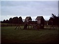
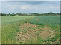
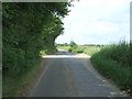
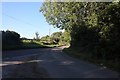
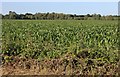
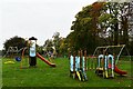
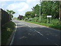
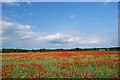
8 photos from this area
Area Information
Key information about the IP25 7PZ including its size, population, and administrative classification.
- Area Type
- Postcode
- Area Size
- 8.7 hectares
- Population
- 2460
- Population Density
- 132 people/km²
House Prices in IP25 7PZ
49
Properties
£163,227
Average Sold Price
£35,000
Lowest Price
£410,000
Highest Price
Showing 49 properties
| Address | Type | Beds | Baths | Last Sale Price | Last Sale Date | |
|---|---|---|---|---|---|---|
| 48 Parklands Avenue, Shipdham, IP25 7PZ | Semi-detached | 2 | 1 | £195,000 | Apr 2025 | |
| 17 Parklands Avenue, Shipdham, IP25 7PZ | Semi-detached | 2 | 1 | £205,000 | May 2024 | |
| 12 Parklands Avenue, Shipdham, IP25 7PZ | Detached | 4 | 2 | £410,000 | Dec 2023 | |
| 3 Parklands Avenue, Shipdham, IP25 7PZ | Bungalow | 2 | 1 | £228,000 | Nov 2023 | |
| 19 Parklands Avenue, Shipdham, IP25 7PZ | Terraced | 2 | 1 | £180,000 | Apr 2023 | |
| 46 Parklands Avenue, Shipdham, IP25 7PZ | Semi-detached | 2 | 1 | £190,000 | Apr 2023 | |
| 11 Parklands Avenue, Shipdham, IP25 7PZ | Semi-detached | 2 | 1 | £212,000 | Mar 2023 | |
| 35 Parklands Avenue, Shipdham, IP25 7PZ | Semi-detached | 3 | 1 | £295,000 | Dec 2022 | |
| 20 Parklands Avenue, Shipdham, IP25 7PZ | Bungalow | 3 | 1 | £280,000 | Jul 2022 | |
| 28 Parklands Avenue, Shipdham, IP25 7PZ | Retail | 2 | 1 | £220,000 | May 2022 |
Page 1 of 5
Energy Efficiency in IP25 7PZ
Amenities
Schools
| Rank | School | Type | Entry gender | Ages |
|---|
Explore more schools in this area
Go to Schools tabDemographics
Household Size
Two person
most common
Accommodation Type
Houses
most common
Tenure
73
majority
Ethnic Group
White
most common
Religion
N/A
most common
Household Composition
N/A
most common
Age
47
median
Adults (30-64 years)
most common
Household Deprivation
N/A
with no deprivation
NS-SEC
27
in Lower managerial occupations
Explore more demographic insights in this area
Go to Demographics tabPlanning
Planning Constraints
- Flood RiskPremium
- Ramsar Wetland SitesPremium
- Area of Outstanding Natural BeautyPremium
- Protected Nature ReservePremium
- Protected WoodlandPremium