Area Overview for IP25 7EW
Photos of IP25 7EW
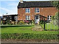
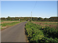
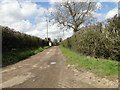
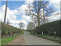
5 photos from this area
Area Information
Key information about the IP25 7EW including its size, population, and administrative classification.
- Area Type
- Postcode
- Area Size
- 44.0 hectares
- Population
- 1050
- Population Density
- 43 people/km²
House Prices in IP25 7EW
57
Properties
-
Average Sold Price
-
Lowest Price
-
Highest Price
Showing 57 properties
| Address | Type | Beds | Baths | Last Sale Price | Last Sale Date | |
|---|---|---|---|---|---|---|
| 157 Hills Road, Saham Hills, Saham Toney, IP25 7EW | Semi-detached | 5 | 3 | - | - | |
| Coot Cottage, 109B Hills Road, Saham Hills, Saham Toney, IP25 7EW | Bungalow | 4 | 1 | - | - | |
| Kintore, 133 Hills Road, Saham Hills, Saham Toney, IP25 7EW | Bungalow | 2 | 1 | - | - | |
| Grasdene, 73 Hills Road, Saham Hills, Saham Toney, IP25 7EW | Bungalow | 3 | 1 | - | - | |
| Woodcote, 107 Hills Road, Saham Hills, Saham Toney, IP25 7EW | Bungalow | 4 | 1 | - | - | |
| Meadow View, 117 Hills Road, Saham Hills, Saham Toney, IP25 7EW | Bungalow | 3 | 1 | - | - | |
| Spindleberry, 115 Hills Road, Saham Hills, Saham Toney, IP25 7EW | Bungalow | 3 | 1 | - | - | |
| 85 Hills Road, Saham Hills, Saham Toney, IP25 7EW | Detached | 4 | 2 | - | - | |
| Appleridge, 147 Hills Road, Saham Hills, Saham Toney, IP25 7EW | Bungalow | 2 | 1 | - | - | |
| Clear Water, 131 Hills Road, Saham Hills, Saham Toney, IP25 7EW | Semi-detached | 2 | 2 | - | - |
Page 1 of 6
Energy Efficiency in IP25 7EW
Amenities
Schools
| Rank | School | Type | Entry gender | Ages |
|---|
Explore more schools in this area
Go to Schools tabDemographics
Household Size
Two person
most common
Accommodation Type
Houses
most common
Tenure
70
majority
Ethnic Group
White
most common
Religion
N/A
most common
Household Composition
N/A
most common
Age
47
median
Adults (30-64 years)
most common
Household Deprivation
N/A
with no deprivation
NS-SEC
33
in Lower managerial occupations
Explore more demographic insights in this area
Go to Demographics tabPlanning
Planning Constraints
- Flood RiskPremium
- Ramsar Wetland SitesPremium
- Area of Outstanding Natural BeautyPremium
- Protected Nature ReservePremium
- Protected WoodlandPremium
- Crime & SafetyPremium