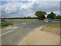
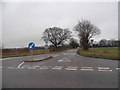
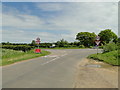
Area Overview for IP25 6RL
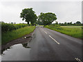
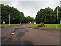
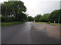
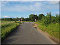
Photos of IP25 6RL
Area Information
IP25 6RL is a compact residential cluster in England, spanning 13.3 hectares and home to 2,615 residents. Its population density of 1,271 people per square kilometre reflects a tightly knit community, where proximity to amenities and services is a defining feature. The area’s small size fosters a sense of familiarity, with residents likely to know their neighbours. Daily life here is shaped by the balance between local convenience and the broader regional context. With no major urban centres nearby, the area caters to those seeking a quieter, more self-contained lifestyle. The absence of protected natural sites or planning constraints means development is likely to remain focused on residential needs. For buyers, this represents a straightforward, low-risk environment, though the moderate crime risk score of 63 suggests standard security measures are advisable. The area’s appeal lies in its simplicity: a place where essential services are within practical reach, and the pace of life is measured.
- Area Type
- Postcode
- Area Size
- 13.3 hectares
- Population
- 2615
- Population Density
- 1271 people/km²
The property market in IP25 6RL is characterised by a 51% home ownership rate, with houses forming the predominant accommodation type. This indicates a market skewed towards owner-occupation rather than rental, suggesting a community of settled residents. The small area size and limited housing stock mean the market is unlikely to be highly competitive, though buyers should consider the limited scope for new development. The focus on houses rather than flats or apartments may appeal to those prioritising space and privacy. For prospective buyers, this environment offers a straightforward purchase process, with fewer complexities from planning restrictions or environmental designations. However, the small scale of the area means property values may be influenced more by local factors than broader regional trends.
House Prices in IP25 6RL
Showing 1 properties
| Address | Type | Beds | Baths | Last Sale Price | Last Sale Date | |
|---|---|---|---|---|---|---|
| Social Club, Hm Prison Wayland, Hmp Access Road, Griston, IP25 6RL | commercial | - | - | - | - |
Energy Efficiency in IP25 6RL
Residents of IP25 6RL have access to four retail amenities within practical reach, including Spar, Lidl Watton, and Tesco Watton. These stores provide essential shopping options, from groceries to everyday necessities, reducing the need for longer trips. The presence of multiple retail outlets suggests a focus on convenience, catering to daily needs without requiring travel beyond the immediate area. While the data does not specify dining or leisure options, the proximity of these shops implies a functional, community-oriented lifestyle. The small cluster nature of the area means amenities are closely grouped, enhancing accessibility. For those prioritising self-sufficiency, this setup offers a practical balance between local resources and the broader regional economy.
Amenities
Schools
| Rank | School | Type | Entry gender | Ages |
|---|
Explore more schools in this area
Go to Schools tabDemographics
The population of IP25 6RL is predominantly adults aged 30–64, with a median age of 47. This suggests a mature, stable community, likely with established careers and family structures. Home ownership is strong, at 51%, indicating a significant portion of residents are long-term residents rather than renters. The accommodation type is primarily houses, which aligns with the area’s lower population density and the preference for private, standalone living. The predominant ethnic group is White, reflecting a homogeneous demographic profile. While this data does not specify deprivation levels, the absence of protected sites or environmental constraints may contribute to a relatively stable quality of life. The age profile suggests a community with a mix of active professionals and retirees, creating a balanced social dynamic.
Household Size
Accommodation Type
Tenure
Ethnic Group
Religion
Household Composition
Age
Household Deprivation
NS-SEC
Explore more demographic insights in this area
Go to Demographics tabPlanning
Planning Constraints
- Flood RiskPremium
- Ramsar Wetland SitesPremium
- Area of Outstanding Natural BeautyPremium
- Protected Nature ReservePremium
- Protected WoodlandPremium