Area Overview for IP25 6AD
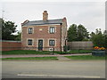
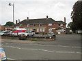
Photos of IP25 6AD


Area Information
IP25 6AD is a small residential postcode area in England, home to around 1,390 people. It is a compact cluster of properties, primarily houses, catering to a community of adults aged 30–64, with a median age of 47. This suggests a mature, settled population, likely with established careers and families. The area’s size means it is not densely populated, offering a quiet, low-key living environment. Daily life here is likely characterised by a close-knit community, with local amenities and schools within easy reach. While the area lacks large-scale urban features, its small footprint ensures a manageable, perhaps even intimate, sense of neighbourhood. Residents may prioritise convenience over sprawling infrastructure, with local shops and services meeting everyday needs. The absence of significant environmental constraints—such as protected woodlands or AONB areas—suggests a practical, unencumbered setting for housing. For those seeking a tranquil, low-maintenance lifestyle, IP25 6AD could be an appealing choice, though its limited size may mean opportunities for expansion or development are constrained.
- Area Type
- Postcode
- Area Size
- Not available
- Population
- 1390
- Population Density
- Not available
The property market in IP25 6AD is defined by a low home ownership rate of 34%, indicating that the majority of residents are likely tenants rather than homeowners. The accommodation type is predominantly houses, which is unusual for areas with high rental markets, suggesting a mix of owner-occupied and rented properties. Given the area’s small size and limited population, the housing stock is constrained, with few options for buyers seeking properties in the immediate vicinity. This could make the area more attractive to renters, particularly those seeking stable, long-term housing in a quiet setting. The focus on houses rather than flats or apartments may appeal to families or individuals preferring larger living spaces. However, the limited availability of properties means that buyers may need to look beyond the immediate area for more options. The market’s character is likely shaped by the demographic profile—adults aged 30–64—suggesting a demand for practical, family-friendly homes rather than speculative investment properties.
House Prices in IP25 6AD
No properties found in this postcode.
Energy Efficiency in IP25 6AD
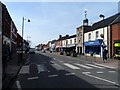
The lifestyle in IP25 6AD is shaped by its proximity to essential retail amenities, including Tesco Watton, Lidl Watton, and Spar. These stores provide access to groceries, household items, and convenience services, meeting the daily needs of residents without requiring long commutes. The presence of these three retail outlets suggests a functional, community-focused retail environment, though the variety is limited to basic necessities. Beyond shopping, the area’s small size may mean fewer leisure or entertainment options, with residents likely relying on nearby towns for more diverse amenities. The character of daily life here is likely practical and straightforward, with a focus on convenience and local accessibility. The absence of detailed data on parks or leisure facilities means that outdoor recreation may require travel to adjacent areas. Nonetheless, the availability of nearby shops contributes to a self-contained, low-effort lifestyle, ideal for those prioritising simplicity and ease of access.
Amenities
Schools
The nearest school to IP25 6AD is Watton Westfield Infant and Nursery School, which serves as both a primary school and an academy. It holds an Ofsted rating of ‘good’, indicating a satisfactory standard of education. This single school caters to younger children, offering a primary-level education that is likely the primary option for families in the area. The absence of secondary schools or additional educational institutions in the data suggests that students may need to travel to nearby towns for further education. The presence of a well-rated primary school is a key consideration for families, as it provides a foundation for early learning. However, the limited range of educational options may require careful planning for long-term schooling. The school’s status as an academy may imply a degree of autonomy in its operations, which could influence its curriculum and resources. For parents prioritising proximity to education, this school is a central feature of the area’s appeal.
| Rank | School | Type | Entry gender | Ages |
|---|
Explore more schools in this area
Go to Schools tabDemographics
The population of IP25 6AD is predominantly adults, with 30–64 years being the most common age range. The median age of 47 indicates a mature demographic, suggesting a community with established careers and possibly families. Home ownership is relatively low at 34%, implying that a significant portion of the population resides in rental properties. This could reflect a mix of long-term tenants and temporary occupants, or a market where property ownership is less common. The area is characterised by houses rather than flats, aligning with the housing stock of a smaller, possibly rural or semi-rural setting. The predominant ethnic group is White, which, while not providing data on diversity, suggests a homogenous population. The 34% home ownership rate may influence the local economy, with fewer property transactions and a potential reliance on rental income. However, this also means the area may lack the dynamism of higher-ownership regions. The population size of 1,390 ensures a small, closely connected community, where social ties and local familiarity are likely strong.
Household Size
Accommodation Type
Tenure
Ethnic Group
Religion
Household Composition
Age
Household Deprivation
NS-SEC
Explore more demographic insights in this area
Go to Demographics tabPlanning
Planning Constraints
- Flood RiskPremium
- Ramsar Wetland SitesPremium
- Area of Outstanding Natural BeautyPremium
- Protected Nature ReservePremium
- Protected WoodlandPremium
- Crime & SafetyPremium