Area Overview for IP24 3QY
Photos of IP24 3QY


Area Information
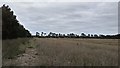
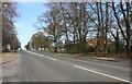
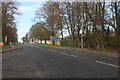
IP24 3QY is a small, compact postcode area in England, covering 9,157 square metres and home to 1,655 residents. It is a residential cluster characterised by a low population density of 184 people per square kilometre, suggesting a quiet, spread-out community. The area’s demographic profile reflects a mature population, with a median age of 47 and most residents aged between 30 and 64. This suggests a stable, established community, with a focus on long-term living rather than transient populations. The housing stock is predominantly owner-occupied, with 43% of homes owned by residents, though the area’s small size means property availability is limited. Proximity to Thetford Railway Station and nearby retail hubs like Iceland Thetford and Sainsburys Thetford adds practical convenience. While the area lacks major natural features, its proximity to RAF Honington and regional rail links offers connectivity to broader networks. Living here balances seclusion with access to essential services, though the small scale means amenities are modest and community interaction is likely frequent.
- Area Type
- Postcode
- Area Size
- 9157 m²
- Population
- 1655
- Population Density
- 184 people/km²
The property market in IP24 3QY is small and characterised by a mix of owner-occupied and rented homes, with 43% of properties owned by residents. The accommodation type is predominantly houses, which is typical of low-density, suburban areas. This suggests a market where larger, more traditional homes are available, possibly with gardens or outdoor space. The limited area size means the housing stock is finite, which could affect availability and competition for properties. Buyers should consider the local market’s small scale, which may mean fewer options compared to larger towns. The presence of rail links to Thetford and Brandon could appeal to commuters, though the area’s isolation from major cities may limit investment potential. For those seeking a quiet, established home, the market offers a chance to own in a low-density environment, but the lack of high-rise or apartment blocks means it is not suited to those needing urban living.
House Prices in IP24 3QY
No properties found in this postcode.
Energy Efficiency in IP24 3QY
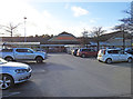
The lifestyle in IP24 3QY is shaped by its proximity to practical amenities. Nearby retail options include Lidl Barnham, Iceland Thetford, and Sainsburys Thetford, providing access to grocery shopping and daily essentials. The three railway stations—Thetford, Entrance, and Brandon—offer regular services to nearby towns, facilitating travel for work, leisure, or socialising. The presence of RAF Honington adds a unique element to the area, though its impact on local life is not specified. For residents, the combination of retail, rail, and military infrastructure creates a functional but modest lifestyle. The area’s small size means community interactions are likely frequent, but the lack of major leisure or entertainment venues suggests a focus on practical living over urban amenities. The retail options and rail links provide convenience, but the absence of cafes, parks, or cultural hubs means residents may need to travel further for a broader range of activities.
Amenities
Schools
The schools nearest to IP24 3QY include the Senior Tutorial Centre, Southern Area Pupil Referral Unit, and Southern Area Pupil Referral Unit, Elm Road Centre. These institutions are not traditional schools but are likely specialist centres catering to students with specific educational needs, such as those with behavioural or learning challenges. The absence of primary or secondary schools in the data suggests that families may need to look further afield for mainstream education. This could be a consideration for parents prioritising local schooling, though the area’s proximity to Thetford may provide nearby alternatives. The mix of school types indicates a focus on supporting students with non-traditional educational requirements, but it does not offer the full range of academic or extracurricular opportunities typically found in a comprehensive school system.
| Rank | School | Type | Entry gender | Ages |
|---|
Explore more schools in this area
Go to Schools tabDemographics
The population of IP24 3QY is 1,655, with a median age of 47, indicating a mature, stable demographic. The majority of residents fall within the 30-64 age range, suggesting a community of working-age adults and older individuals. Home ownership is relatively low at 43%, with the remaining properties likely rented. The accommodation type is predominantly houses, reflecting a suburban or semi-rural character. The predominant ethnic group is White, though no further breakdown of diversity is provided. The population density of 184 people per square kilometre implies a low-density, spread-out settlement, which may influence the pace of life and social dynamics. This profile suggests a community focused on stability, with fewer young families or transient populations. The absence of specific deprivation data means quality of life factors like access to services or employment opportunities are not quantified here.
Household Size
Accommodation Type
Tenure
Ethnic Group
Religion
Household Composition
Age
Household Deprivation
NS-SEC
Explore more demographic insights in this area
Go to Demographics tabPlanning
Planning Constraints
- Flood RiskPremium
- Ramsar Wetland SitesPremium
- Area of Outstanding Natural BeautyPremium
- Protected Nature ReservePremium
- Protected WoodlandPremium