Area Overview for IP24 2XU
Photos of IP24 2XU
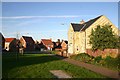
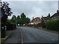
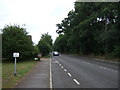
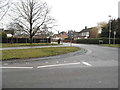
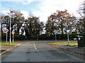
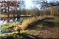


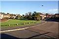
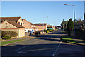
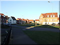
11 photos from this area
Area Information
Key information about the IP24 2XU including its size, population, and administrative classification.
- Area Type
- Postcode
- Area Size
- 5482 m²
- Population
- 1207
- Population Density
- 4834 people/km²
House Prices in IP24 2XU
12
Properties
£221,740
Average Sold Price
£135,000
Lowest Price
£395,000
Highest Price
Showing 12 properties
| Address | Type | Beds | Baths | Last Sale Price | Last Sale Date | |
|---|---|---|---|---|---|---|
| 30 Campion Road, Thetford, IP24 2XU | Detached | - | - | £214,900 | Mar 2025 | |
| 28 Campion Road, Thetford, IP24 2XU | Detached | 4 | 2 | £395,000 | Dec 2024 | |
| 26 Campion Road, Thetford, IP24 2XU | Semi-detached | 3 | 1 | £230,000 | Jan 2023 | |
| 22 Campion Road, Thetford, IP24 2XU | house | - | - | £205,000 | Sep 2021 | |
| 24 Campion Road, Thetford, IP24 2XU | Semi-detached | 3 | 1 | £237,000 | Jun 2021 | |
| 20 Campion Road, Thetford, IP24 2XU | house | - | - | £175,000 | Dec 2016 | |
| 34 Campion Road, Thetford, IP24 2XU | Detached | 4 | - | £187,000 | Dec 2012 | |
| 18 Campion Road, Thetford, IP24 2XU | house | 3 | - | £135,000 | Dec 2011 | |
| 36 Campion Road, Thetford, IP24 2XU | house | - | - | £245,000 | Feb 2010 | |
| 32 Campion Road, Thetford, IP24 2XU | Detached | - | - | £193,500 | Nov 2004 |
Page 1 of 2
Energy Efficiency in IP24 2XU
Amenities
Schools
| Rank | School | Type | Entry gender | Ages |
|---|
Explore more schools in this area
Go to Schools tabDemographics
Household Size
Family (3-5 people)
most common
Accommodation Type
Houses
most common
Tenure
69
majority
Ethnic Group
White
most common
Religion
N/A
most common
Household Composition
N/A
most common
Age
47
median
Adults (30-64 years)
most common
Household Deprivation
N/A
with no deprivation
NS-SEC
28
in Lower managerial occupations
Explore more demographic insights in this area
Go to Demographics tabPlanning
Planning Constraints
- Flood RiskPremium
- Ramsar Wetland SitesPremium
- Area of Outstanding Natural BeautyPremium
- Protected Nature ReservePremium
- Protected WoodlandPremium