Area Overview for IP24 2LR
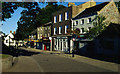
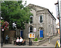
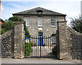
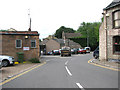
Photos of IP24 2LR


Area Information
Living in IP24 2LR means being part of a tightly knit residential cluster in England, where the 1650 residents occupy just 4.12 hectares of land. This small area, with a population density of 400,468 people per square kilometre, reflects a compact, closely connected community. The area’s character is shaped by its modest scale and the presence of local amenities within walking or short driving distance. Residents here are predominantly adults aged 30–64, with a median age of 47, suggesting a mature demographic focused on stability. The area’s proximity to Thetford and surrounding towns offers access to broader services while maintaining a sense of local identity. With 61% of homes owned by residents, IP24 2LR is largely an owner-occupied area, reinforcing a sense of permanence. Daily life is punctuated by nearby shops, rail links, and a low crime score, making it a practical choice for those prioritising safety and convenience. The area’s small footprint means it’s not sprawling, but its strategic location near transport routes and retail hubs ensures it remains functional for a range of lifestyles.
- Area Type
- Postcode
- Area Size
- 4120 m²
- Population
- 1650
- Population Density
- 4588 people/km²
IP24 2LR is primarily an owner-occupied area, with 61% of homes owned by residents rather than rented. This suggests a market where long-term residency is the norm, with fewer speculative investments or rental properties. The accommodation type is predominantly houses, which is unusual for a small postcode area but may indicate a focus on family homes or larger properties. Given the area’s compact size, the housing stock is likely limited, meaning buyers may need to consider nearby postcode areas for more options. The high home ownership rate also implies that property values here are less volatile compared to rental markets, offering potential security for buyers. However, the small scale of the area means that the property market is not diverse, and buyers should be aware of limited choices. For those seeking a house in IP24 2LR, the emphasis on owner-occupation and the presence of houses suggests a market suited to settled, long-term residents rather than short-term investors.
House Prices in IP24 2LR
Showing 1 properties
| Address | Type | Beds | Baths | Last Sale Price | Last Sale Date | |
|---|---|---|---|---|---|---|
| 48 Vicarage Road, Thetford, IP24 2LR | Detached | - | - | - | - |
Energy Efficiency in IP24 2LR
Residents of IP24 2LR have access to a range of local amenities within practical reach. The retail sector includes Aldi East, Tesco Thetford, and Farmfoods East, providing essential shopping and grocery needs. These stores cater to daily requirements, reducing the need for long trips to larger centres. The area’s rail links to Thetford, Brandon, and Entrance offer access to broader services, including healthcare, entertainment, and cultural attractions in nearby towns. While the data does not mention parks or leisure facilities, the absence of planning constraints like AONB or protected woodlands suggests open spaces may be available nearby. The combination of retail options, rail connectivity, and proximity to regional hubs means daily life in IP24 2LR balances local convenience with the ability to access wider amenities.
Amenities
Schools
The nearest school to IP24 2LR is Emmanuel Christian School, an independent institution. This type of school typically offers alternative educational approaches, often with smaller class sizes and distinct curricula compared to state-run schools. While no Ofsted rating is provided, the presence of an independent school may appeal to families seeking non-traditional education options. The area’s limited school options mean that parents must consider proximity to other educational institutions in nearby towns like Thetford or Brandon. For families prioritising a specific educational environment, Emmanuel Christian School could be a key factor in deciding to live in IP24 2LR. However, the absence of state schools in the immediate area means that children may need to commute further for secondary education or other services.
| Rank | School | Type | Entry gender | Ages |
|---|
Explore more schools in this area
Go to Schools tabDemographics
The population of IP24 2LR is 1650, with a median age of 47, indicating a community skewed towards middle-aged and older adults. The most common age range is 30–64, suggesting a stable, established population with strong family ties. Home ownership is high at 61%, reflecting a preference for long-term residency over rental properties. The predominant accommodation type is houses, which aligns with the area’s residential character. The majority of residents identify as White, with no specific data on other ethnic groups provided. This demographic profile suggests a community with low turnover and a focus on continuity. The absence of detailed deprivation data means it’s unclear how economic factors influence quality of life, but the high home ownership rate and low crime score imply a relatively secure environment. For families or retirees, the area’s mature age profile and housing stock may offer a sense of familiarity and stability.
Household Size
Accommodation Type
Tenure
Ethnic Group
Religion
Household Composition
Age
Household Deprivation
NS-SEC
Explore more demographic insights in this area
Go to Demographics tabPlanning
Planning Constraints
- Flood RiskPremium
- Ramsar Wetland SitesPremium
- Area of Outstanding Natural BeautyPremium
- Protected Nature ReservePremium
- Protected WoodlandPremium