Area Overview for IP24 2ED
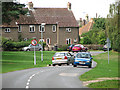
Photos of IP24 2ED


Area Information
Living in IP24 2ED means being part of a small, defined residential cluster in England with a population of 2,431. This area is characterised by its compact size and the presence of established housing stock, predominantly homes rather than flats. The community is largely composed of adults aged 30–64, reflecting a mature demographic with a median age of 47. Daily life here is shaped by the proximity to local amenities, including retail outlets, rail connections, and a nearby airport. While the area is not expansive, its accessibility to key services like schools and transport hubs makes it practical for families and commuters. The low flood risk and absence of environmental constraints such as AONB or protected woodlands suggest a relatively straightforward planning landscape. However, the area’s small size means its housing stock is limited, which can influence property availability and market dynamics. For those seeking a quiet, established residential setting with a balance of local convenience and connectivity, IP24 2ED offers a distinct profile.
- Area Type
- Postcode
- Area Size
- Not available
- Population
- 2431
- Population Density
- 2760 people/km²
The property market in IP24 2ED is defined by a 49% home ownership rate, indicating that just under half of residents own their homes, while the remainder are likely to be in the rental market. The area is predominantly composed of houses rather than flats, which is typical of smaller residential clusters. This housing stock suggests a limited number of properties, given the area’s small population of 2,431. For buyers, this means the market is likely to be niche, with properties potentially being more spread out or requiring a focus on specific locations within the postcode. The absence of high-density housing or commercial development implies that the area is not a hotspot for investment or speculative buying. Instead, it caters to those seeking a settled, low-maintenance environment with established homes. Prospective buyers should consider the limited housing stock and the potential for competition among those targeting this specific postcode.
House Prices in IP24 2ED
No properties found in this postcode.
Energy Efficiency in IP24 2ED
The lifestyle in IP24 2ED is shaped by its proximity to essential amenities within practical reach. Retail options include five venues, with notable stores such as Farmfoods East, Iceland Thetford, and Aldi East, providing everyday shopping convenience. The area’s rail connections to Thetford, Brandon, and Entrance stations offer access to broader regional networks, while RAF Honington airport provides air travel options for those requiring it. Though the data does not specify parks or leisure facilities, the presence of retail and transport hubs suggests a practical, functional lifestyle. The mix of retail and transport amenities supports daily routines, from grocery shopping to commuting. However, the absence of detailed information on leisure or recreational spaces means the area’s character beyond these practical aspects remains less defined. For residents prioritising convenience over expansive leisure options, IP24 2ED delivers a straightforward, service-focused lifestyle.
Amenities
Schools
Residents of IP24 2ED have access to several educational institutions, including Norwich Road Community Primary School, which serves younger children, and Norwich Road Academy, an academy with a good Ofsted rating. A second academy, also named Norwich Road Academy, shares the same rating, indicating consistent performance across these institutions. The area also includes The Damara School, a special school with a good Ofsted rating, providing tailored education for students with specific needs. This mix of school types offers families a range of options, from primary education to specialist provision. The presence of two academies with good ratings suggests a strong local education infrastructure, though the absence of secondary schools in the data means families may need to look beyond the immediate area for comprehensive schooling. The proximity of these schools to homes in IP24 2ED makes it a viable option for families prioritising educational quality.
| Rank | School | Type | Entry gender | Ages |
|---|---|---|---|---|
| 1 | Norwich Road Community Primary School | primary | N/A | N/A |
| 2 | Norwich Road Academy | academy | N/A | N/A |
| 3 | Norwich Road Academy | academy | N/A | N/A |
| 4 | The Damara School | special | N/A | N/A |
Explore more schools in this area
Go to Schools tabDemographics
The community in IP24 2ED is predominantly composed of adults aged 30–64, with a median age of 47. Home ownership here stands at 49%, indicating a mix of owner-occupied and rental properties. The area is characterised by a high proportion of houses rather than flats, reflecting a traditional residential pattern. The predominant ethnic group is White, though specific data on diversity or deprivation is not provided. This age profile suggests a population that is largely settled, with fewer young families or elderly residents compared to other areas. The 49% home ownership rate implies that nearly half of residents rent, which may influence the local property market’s dynamics. The absence of detailed diversity statistics means the community’s social composition remains less defined in the data. However, the age and housing profiles suggest a stable, established population with established routines and needs.
Household Size
Accommodation Type
Tenure
Ethnic Group
Religion
Household Composition
Age
Household Deprivation
NS-SEC
Explore more demographic insights in this area
Go to Demographics tabPlanning
Planning Constraints
- Flood RiskPremium
- Ramsar Wetland SitesPremium
- Area of Outstanding Natural BeautyPremium
- Protected Nature ReservePremium
- Protected WoodlandPremium
- Crime RiskPremium