Area Overview for IP22 4WT
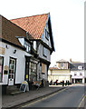
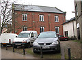
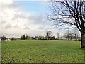
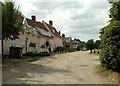
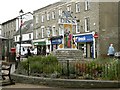
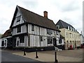
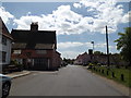
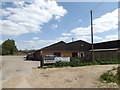
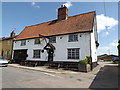
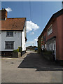
Photos of IP22 4WT


Area Information
IP22 4WT is a small, tightly packed residential postcode in England, covering just 1.9 hectares. With a population of 1739 people, it is one of the most densely populated areas in the country, at 92,481 people per square kilometre. This compact cluster of homes suggests a focused, community-oriented environment, though its size means amenities and services are limited to nearby Diss. The area’s residents are predominantly adults aged 30–64, reflecting a mature, stable demographic. Living here means proximity to essential services, but the small scale of the area means daily life is closely tied to nearby Diss, where retail and transport hubs are located. The high population density, while efficient, may impact privacy and space. For those seeking a quiet, residential setting with easy access to Diss, IP22 4WT offers a blend of compact living and practical connectivity, though its size means it is best suited for those prioritising convenience over expansive outdoor space.
- Area Type
- Postcode
- Area Size
- 1.9 hectares
- Population
- 1739
- Population Density
- 2270 people/km²
The property market in IP22 4WT is characterised by a 51% home ownership rate, indicating a balance between owner-occupied homes and rental properties. The predominant accommodation type is houses, which suggests the area is not dominated by flats or apartments. Given the small area size of 1.9 hectares and high population density, the housing stock is likely limited in number, with properties closely spaced. This compactness may make the area appealing for buyers seeking a smaller, manageable footprint, though it also means the market is not expansive. For those considering purchase, the proximity to Diss—home to major retailers like Aldi, Morrisons, and Tesco—could be a key selling point. However, the limited local amenities mean buyers should assess their reliance on nearby Diss for daily needs. The housing stock’s focus on houses may appeal to families or those prioritising space, but the small area size means the market is best suited for those seeking a tightly knit residential environment with easy access to regional services.
House Prices in IP22 4WT
No properties found in this postcode.
Energy Efficiency in IP22 4WT
Residents of IP22 4WT have access to essential retail services in nearby Diss, including Aldi Diss, Morrisons Diss, and Tesco Diss. These stores provide a range of shopping options, from groceries to household goods, supporting daily needs within a short distance. The area’s proximity to Diss Railway Station also connects residents to broader transport networks, facilitating travel to work, leisure, or other destinations. While the immediate area lacks major parks or leisure facilities, the nearby Diss town centre likely offers additional amenities. The compact nature of IP22 4WT means that daily life revolves around the nearby Diss hub, where residents can access dining, retail, and transport. This arrangement suits those who prioritise convenience and proximity to services, though it may limit the availability of local green spaces or recreational areas within the postcode itself.
Amenities
Schools
| Rank | School | Type | Entry gender | Ages |
|---|
Explore more schools in this area
Go to Schools tabDemographics
The community in IP22 4WT is predominantly composed of adults aged 30–64, with a median age of 47. This suggests a population that is largely in their prime working years, likely with established careers and families. Home ownership here is at 51%, slightly below the national average, indicating a mix of owner-occupied properties and rental units. The accommodation type is primarily houses, which may reflect a preference for more spacious living compared to flats. The predominant ethnic group is White, with no specific data on other groups provided. The high population density—over 92,000 people per square kilometre—means the area is intensely populated, which can influence local dynamics, such as shared community spaces and proximity to services. However, this density does not necessarily correlate with deprivation, as the data does not specify income levels or socioeconomic factors. Residents here likely benefit from the compact nature of the area, though the lack of detailed diversity metrics means the full range of community experiences remains unexplored.
Household Size
Accommodation Type
Tenure
Ethnic Group
Religion
Household Composition
Age
Household Deprivation
NS-SEC
Explore more demographic insights in this area
Go to Demographics tabPlanning
Planning Constraints
- Flood RiskPremium
- Ramsar Wetland SitesPremium
- Area of Outstanding Natural BeautyPremium
- Protected Nature ReservePremium
- Protected WoodlandPremium