Area Overview for IP22 4NW
Photos of IP22 4NW
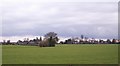
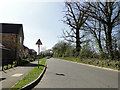

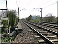
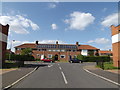
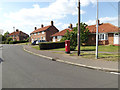
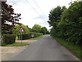
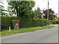
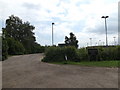
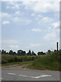
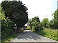
44 photos from this area
Area Information
Key information about the IP22 4NW including its size, population, and administrative classification.
- Area Type
- Postcode
- Area Size
- 2.1 hectares
- Population
- 1647
- Population Density
- 717 people/km²
House Prices in IP22 4NW
44
Properties
£160,703
Average Sold Price
£34,250
Lowest Price
£230,000
Highest Price
Showing 44 properties
| Address | Type | Beds | Baths | Last Sale Price | Last Sale Date | |
|---|---|---|---|---|---|---|
| 48 Willbye Avenue, Diss, IP22 4NW | house | 2 | 1 | £210,000 | Jul 2024 | |
| 46 Willbye Avenue, Diss, IP22 4NW | Terraced | 3 | 1 | £205,000 | May 2023 | |
| 76 Willbye Avenue, Diss, IP22 4NW | Retail | 3 | 1 | £230,000 | Apr 2022 | |
| 24 Willbye Avenue, Diss, IP22 4NW | Semi-detached | 3 | 1 | £225,000 | Jan 2020 | |
| 44 Willbye Avenue, Diss, IP22 4NW | Terraced | 3 | 1 | £188,000 | Sep 2019 | |
| 36 Willbye Avenue, Diss, IP22 4NW | house | - | - | £215,000 | Jun 2017 | |
| 18 Willbye Avenue, Diss, IP22 4NW | house | - | - | £168,300 | Sep 2016 | |
| 22 Willbye Avenue, Diss, IP22 4NW | house | - | - | £152,500 | Jun 2016 | |
| 58 Willbye Avenue, Diss, IP22 4NW | Semi-detached | 3 | 1 | £198,500 | Jun 2016 | |
| 54 Willbye Avenue, Diss, IP22 4NW | house | - | - | £137,000 | Jul 2013 |
Page 1 of 5
Energy Efficiency in IP22 4NW
Amenities
Schools
| Rank | School | Type | Entry gender | Ages |
|---|
Explore more schools in this area
Go to Schools tabDemographics
Household Size
One person
most common
Accommodation Type
Houses
most common
Tenure
55
majority
Ethnic Group
White
most common
Religion
N/A
most common
Household Composition
N/A
most common
Age
47
median
Adults (30-64 years)
most common
Household Deprivation
N/A
with no deprivation
NS-SEC
24
in Lower managerial occupations
Explore more demographic insights in this area
Go to Demographics tabPlanning
Planning Constraints
- Flood RiskPremium
- Ramsar Wetland SitesPremium
- Area of Outstanding Natural BeautyPremium
- Protected Nature ReservePremium
- Protected WoodlandPremium