Area Overview for IP22 4NE
Photos of IP22 4NE
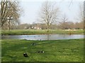
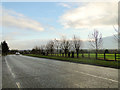
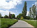
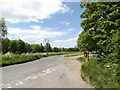

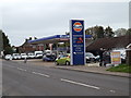
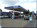
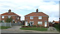
48 photos from this area
Area Information
Key information about the IP22 4NE including its size, population, and administrative classification.
- Area Type
- Postcode
- Area Size
- 2.4 hectares
- Population
- 1332
- Population Density
- 1113 people/km²
House Prices in IP22 4NE
7
Properties
£145,766
Average Sold Price
£56,650
Lowest Price
£215,000
Highest Price
Showing 7 properties
| Address | Type | Beds | Baths | Last Sale Price | Last Sale Date | |
|---|---|---|---|---|---|---|
| 19 Factory Lane, Diss, IP22 4NE | Bungalow | 2 | - | £149,995 | Apr 2010 | |
| 17 Factory Lane, Diss, IP22 4NE | house | - | - | £208,000 | Feb 2007 | |
| 27 Factory Lane, Diss, IP22 4NE | Semi-detached | - | - | £215,000 | Nov 2004 | |
| 15 Factory Lane, Diss, IP22 4NE | Bungalow | - | - | £139,950 | Mar 2004 | |
| 23 Factory Lane, Diss, IP22 4NE | Semi-detached | - | - | £105,000 | May 2003 | |
| 21 Factory Lane, Diss, IP22 4NE | Semi-detached | - | - | £56,650 | Jun 1997 | |
| 25 Factory Lane, Diss, IP22 4NE | Semi-detached | 4 | 1 | - | - |
Energy Efficiency in IP22 4NE
Amenities
Schools
| Rank | School | Type | Entry gender | Ages |
|---|
Explore more schools in this area
Go to Schools tabDemographics
Household Size
Two person
most common
Accommodation Type
Houses
most common
Tenure
71
majority
Ethnic Group
White
most common
Religion
N/A
most common
Household Composition
N/A
most common
Age
47
median
Adults (30-64 years)
most common
Household Deprivation
N/A
with no deprivation
NS-SEC
30
in Lower managerial occupations
Explore more demographic insights in this area
Go to Demographics tabPlanning
Planning Constraints
- Flood RiskPremium
- Ramsar Wetland SitesPremium
- Area of Outstanding Natural BeautyPremium
- Protected Nature ReservePremium
- Protected WoodlandPremium