Area Overview for IP22 4LW
Photos of IP22 4LW


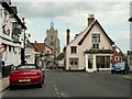
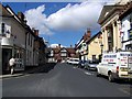

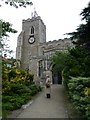
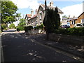
100 photos from this area
Area Information
Key information about the IP22 4LW including its size, population, and administrative classification.
- Area Type
- Postcode
- Area Size
- 2.7 hectares
- Population
- 1541
- Population Density
- 2469 people/km²
House Prices in IP22 4LW
38
Properties
£320,130
Average Sold Price
£212,500
Lowest Price
£475,000
Highest Price
Showing 38 properties
| Address | Type | Beds | Baths | Last Sale Price | Last Sale Date | |
|---|---|---|---|---|---|---|
| 79 Roydon Road, Diss, IP22 4LW | Detached | 4 | 2 | £370,000 | Feb 2025 | |
| 83 Roydon Road, Diss, IP22 4LW | Detached | 4 | 2 | £375,000 | Feb 2025 | |
| 69 Roydon Road, Diss, IP22 4LW | house | - | - | £475,000 | Jun 2023 | |
| 91 Roydon Road, Diss, IP22 4LW | Detached | 4 | 2 | £390,000 | Jan 2023 | |
| 65 Roydon Road, Diss, IP22 4LW | house | 4 | - | £430,000 | Oct 2022 | |
| 20 Roydon Road, Diss, IP22 4LW | house | - | - | £410,000 | Nov 2021 | |
| 49 Roydon Road, Diss, IP22 4LW | Bungalow | - | - | £327,000 | Sep 2021 | |
| 51 Roydon Road, Diss, IP22 4LW | Bungalow | - | - | £330,000 | Jun 2021 | |
| 89 Roydon Road, Diss, IP22 4LW | Detached | 4 | 2 | £320,000 | Mar 2021 | |
| 81 Roydon Road, Diss, IP22 4LW | Detached | 4 | 1 | £300,000 | Jan 2019 |
Page 1 of 4
Energy Efficiency in IP22 4LW
Amenities
Schools
| Rank | School | Type | Entry gender | Ages |
|---|
Explore more schools in this area
Go to Schools tabDemographics
Household Size
Two person
most common
Accommodation Type
Houses
most common
Tenure
76
majority
Ethnic Group
White
most common
Religion
N/A
most common
Household Composition
N/A
most common
Age
47
median
Adults (30-64 years)
most common
Household Deprivation
N/A
with no deprivation
NS-SEC
34
in Lower managerial occupations
Explore more demographic insights in this area
Go to Demographics tabPlanning
Planning Constraints
- Flood RiskPremium
- Ramsar Wetland SitesPremium
- Area of Outstanding Natural BeautyPremium
- Protected Nature ReservePremium
- Protected WoodlandPremium