Area Overview for IP22 4LS
Photos of IP22 4LS


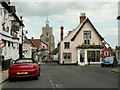
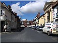

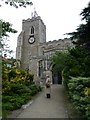
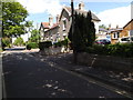
100 photos from this area
Area Information
Key information about the IP22 4LS including its size, population, and administrative classification.
- Area Type
- Postcode
- Area Size
- 4633 m²
- Population
- 1541
- Population Density
- 2469 people/km²
House Prices in IP22 4LS
12
Properties
£140,278
Average Sold Price
£75,000
Lowest Price
£254,000
Highest Price
Showing 12 properties
| Address | Type | Beds | Baths | Last Sale Price | Last Sale Date | |
|---|---|---|---|---|---|---|
| 30 Louies Lane, Diss, IP22 4LS | Semi-detached | 2 | 1 | £254,000 | Apr 2023 | |
| 44 Louies Lane, Diss, IP22 4LS | Flat | - | - | £106,000 | Jan 2018 | |
| 48 Louies Lane, Diss, IP22 4LS | Terraced | 1 | - | £95,000 | Nov 2015 | |
| 46 Louies Lane, Diss, IP22 4LS | Flat | - | - | £75,000 | Jul 2014 | |
| Olive Tree Cottage, 38 Louies Lane, Diss, IP22 4LS | Detached | 3 | 2 | £125,000 | Jul 2012 | |
| 30A Louies Lane, Diss, IP22 4LS | Detached | 4 | 2 | £235,000 | Oct 2006 | |
| 34 Louies Lane, Diss, IP22 4LS | Detached | - | - | £165,000 | May 2003 | |
| 32 Louies Lane, Diss, IP22 4LS | Detached | - | - | £115,000 | Oct 2000 | |
| 32A Louies Lane, Diss, IP22 4LS | Detached | - | - | £92,500 | Dec 1999 | |
| 44B Louies Lane, Diss, IP22 4LS | Flat | 1 | 1 | - | - |
Page 1 of 2
Energy Efficiency in IP22 4LS
Amenities
Schools
| Rank | School | Type | Entry gender | Ages |
|---|
Explore more schools in this area
Go to Schools tabDemographics
Household Size
Two person
most common
Accommodation Type
Houses
most common
Tenure
76
majority
Ethnic Group
White
most common
Religion
N/A
most common
Household Composition
N/A
most common
Age
47
median
Adults (30-64 years)
most common
Household Deprivation
N/A
with no deprivation
NS-SEC
34
in Lower managerial occupations
Explore more demographic insights in this area
Go to Demographics tabPlanning
Planning Constraints
- Flood RiskPremium
- Ramsar Wetland SitesPremium
- Area of Outstanding Natural BeautyPremium
- Protected Nature ReservePremium
- Protected WoodlandPremium