Area Overview for IP22 4GP
Photos of IP22 4GP


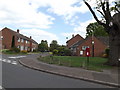
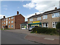
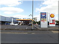
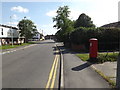
100 photos from this area
Area Information
Key information about the IP22 4GP including its size, population, and administrative classification.
- Area Type
- Postcode
- Area Size
- 3.3 hectares
- Population
- 2138
- Population Density
- 1621 people/km²
House Prices in IP22 4GP
86
Properties
£185,343
Average Sold Price
£75,000
Lowest Price
£367,000
Highest Price
Showing 86 properties
| Address | Type | Beds | Baths | Last Sale Price | Last Sale Date | |
|---|---|---|---|---|---|---|
| 18 Ensign Way, Diss, IP22 4GP | Detached | 5 | 2 | £367,000 | Jun 2025 | |
| 22 Ensign Way, Diss, IP22 4GP | Detached | 3 | 2 | £248,500 | Jun 2025 | |
| 56 Ensign Way, Diss, IP22 4GP | Terraced | 2 | 1 | £209,500 | May 2025 | |
| 85 Ensign Way, Diss, IP22 4GP | Terraced | 2 | 1 | £205,000 | Jan 2025 | |
| 44 Ensign Way, Diss, IP22 4GP | Detached | 4 | 2 | £350,000 | Jun 2023 | |
| 89 Ensign Way, Diss, IP22 4GP | Terraced | 2 | 1 | £210,000 | Oct 2022 | |
| 33 Ensign Way, Diss, IP22 4GP | house | 2 | - | £210,000 | Aug 2022 | |
| 50 Ensign Way, Diss, IP22 4GP | house | - | - | £105,000 | Apr 2022 | |
| 95 Ensign Way, Diss, IP22 4GP | Terraced | 2 | 1 | £200,000 | Feb 2022 | |
| 30 Ensign Way, Diss, IP22 4GP | Detached | 6 | 3 | £325,000 | Jun 2021 |
Page 1 of 9
Energy Efficiency in IP22 4GP
Amenities
Schools
| Rank | School | Type | Entry gender | Ages |
|---|
Explore more schools in this area
Go to Schools tabDemographics
Household Size
Two person
most common
Accommodation Type
Houses
most common
Tenure
59
majority
Ethnic Group
White
most common
Religion
N/A
most common
Household Composition
N/A
most common
Age
47
median
Adults (30-64 years)
most common
Household Deprivation
N/A
with no deprivation
NS-SEC
29
in Lower managerial occupations
Explore more demographic insights in this area
Go to Demographics tabPlanning
Planning Constraints
- Flood RiskPremium
- Ramsar Wetland SitesPremium
- Area of Outstanding Natural BeautyPremium
- Protected Nature ReservePremium
- Protected WoodlandPremium