Area Overview for IP22 2WB
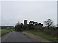
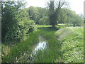
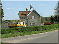
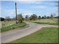
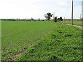
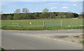
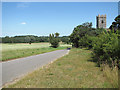
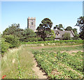
Photos of IP22 2WB


Area Information
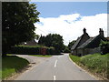
Living in IP22 2WB offers a quiet, low-density lifestyle in a small residential cluster within England. With a population of 1,609 spread across 44 people per square kilometre, the area feels uncluttered and community-focused. The postcode’s compact nature means it is likely centred on a single village or hamlet, with homes predominantly in detached or semi-detached houses. Daily life here is likely characterised by a slower pace, with local amenities and schools within practical reach. The area’s demographics suggest a mature population, with adults aged 30–64 forming the largest group. This hints at a stable, established community where families and long-term residents coexist. Proximity to Harling Road Railway Station and nearby retail options like Spar and Co-op provide essential connectivity, while the absence of major environmental constraints ensures a straightforward living experience. For buyers seeking a peaceful, family-oriented environment with minimal urban pressure, IP22 2WB may be an appealing choice.
- Area Type
- Postcode
- Area Size
- Not available
- Population
- 1609
- Population Density
- 44 people/km²
The property market in IP22 2WB is characterised by a high rate of home ownership (70%) and a predominance of houses over other accommodation types. This suggests a residential area where owner-occupation is the norm, with limited rental properties available. The small population and low density imply a limited housing stock, which could make the market competitive for buyers. Given the focus on houses, properties are likely to be larger and more spread out than in urban areas, appealing to those prioritising space and privacy. For prospective buyers, the area’s compact size means that the immediate surroundings may offer few alternative properties, requiring careful consideration of location and proximity to amenities. The lack of flats or apartments also means that rental options are likely fewer, reinforcing the area’s appeal to those seeking long-term ownership rather than short-term tenancy.
House Prices in IP22 2WB
No properties found in this postcode.
Energy Efficiency in IP22 2WB
The lifestyle in IP22 2WB is shaped by its proximity to essential retail and transport hubs. Local shops such as Spar, East of England Co-operative Co, and Co-op Stanton provide access to groceries, daily essentials, and basic services, reducing the need for long trips to larger centres. The Harling Road Railway Station offers a direct link to rail networks, enabling residents to travel to nearby towns or cities for work, shopping, or leisure. While the area lacks large parks or recreational facilities, the low population density and small size suggest a focus on quiet, residential living rather than extensive leisure infrastructure. The combination of local retail and rail access creates a self-contained environment, ideal for those prioritising convenience and simplicity. For residents, this means a balance between local amenities and the ability to connect to wider regional opportunities.
Amenities
Schools
Residents of IP22 2WB have access to a mix of primary and independent schools. Garboldisham Church Primary School and Garboldisham Church of England Primary Academy are both state-funded primary institutions, with the latter holding a ‘good’ Ofsted rating. These schools cater to younger children, offering local education options for families. Riddlesworth Hall School, an independent institution, provides an alternative for those seeking private education. The presence of both state and independent schools reflects a range of educational choices, though the area’s small size may limit the number of students per school. For parents, this mix allows flexibility between publicly funded education and private schooling, though the distance to these schools may influence daily commutes. The ‘good’ rating at one primary school suggests a reasonably high standard of education in the state sector, which is a key consideration for families prioritising academic outcomes.
| Rank | School | Type | Entry gender | Ages |
|---|
Explore more schools in this area
Go to Schools tabDemographics
The population of IP22 2WB skews towards adults aged 30–64, with a median age of 47. This suggests a community of middle-aged residents, many of whom may be homeowners or long-term residents. Home ownership is high, at 70%, with the majority of properties being houses rather than flats or apartments. The predominant ethnic group is White, which aligns with broader trends in rural and semi-rural areas of England. The low population density of 44 people per square kilometre reinforces the area’s small, unovercrowded character. While specific data on deprivation is not provided, the high home ownership rate and stable age profile suggest a relatively affluent or stable economic environment. This demographic profile indicates a community where families and established professionals may be more prevalent than younger, transient populations.
Household Size
Accommodation Type
Tenure
Ethnic Group
Religion
Household Composition
Age
Household Deprivation
NS-SEC
Explore more demographic insights in this area
Go to Demographics tabPlanning
Planning Constraints
- Flood RiskPremium
- Ramsar Wetland SitesPremium
- Area of Outstanding Natural BeautyPremium
- Protected Nature ReservePremium
- Protected WoodlandPremium