Area Overview for IP22 2QP
Photos of IP22 2QP
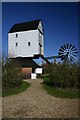
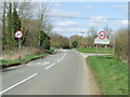
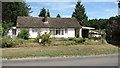
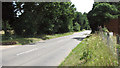
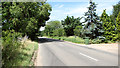
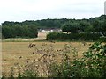
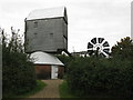

66 photos from this area
Area Information
Key information about the IP22 2QP including its size, population, and administrative classification.
- Area Type
- Postcode
- Area Size
- 46.8 hectares
- Population
- 2394
- Population Density
- 67 people/km²
House Prices in IP22 2QP
12
Properties
£391,938
Average Sold Price
£168,000
Lowest Price
£642,500
Highest Price
Showing 12 properties
| Address | Type | Beds | Baths | Last Sale Price | Last Sale Date | |
|---|---|---|---|---|---|---|
| 45 Smallworth Common, Garboldisham, IP22 2QP | Retail | 3 | 2 | £305,000 | Jun 2022 | |
| Broomscot House, 44 Smallworth Common, Garboldisham, IP22 2QP | house | 4 | - | £452,250 | Jul 2017 | |
| The Chestnuts, Smallworth Common, Garboldisham, IP22 2QP | Detached | 5 | 2 | £642,500 | Aug 2014 | |
| The Retreat, Smallworth Common, Garboldisham, IP22 2QP | Detached | - | - | £168,000 | Mar 2003 | |
| Broomscot Barn, Smallworth Common, Garboldisham, IP22 2QP | Semi-detached | 3 | 2 | - | - | |
| 47 Smallworth Common, Garboldisham, IP22 2QP | Detached | 5 | 2 | - | - | |
| Mobile Home, 46 Smallworth Common, Garboldisham, IP22 2QP | Mobile Home | - | - | - | - | |
| Annexe At, 47 Smallworth Common, Garboldisham, IP22 2QP | Semi-detached | - | - | - | - | |
| Workshop At 45, Smallworth Common, Garboldisham, IP22 2QP | Industrial | - | - | - | - | |
| Annexe, The Chestnuts, Smallworth Common, Garboldisham, IP22 2QP | Flat | - | - | - | - |
Page 1 of 2
Energy Efficiency in IP22 2QP
Amenities
Schools
| Rank | School | Type | Entry gender | Ages |
|---|
Explore more schools in this area
Go to Schools tabDemographics
Household Size
Two person
most common
Accommodation Type
Houses
most common
Tenure
76
majority
Ethnic Group
White
most common
Religion
N/A
most common
Household Composition
N/A
most common
Age
47
median
Adults (30-64 years)
most common
Household Deprivation
N/A
with no deprivation
NS-SEC
37
in Lower managerial occupations
Explore more demographic insights in this area
Go to Demographics tabPlanning
Planning Constraints
- Flood RiskPremium
- Ramsar Wetland SitesPremium
- Area of Outstanding Natural BeautyPremium
- Protected Nature ReservePremium
- Protected WoodlandPremium